Sites and Monuments Record · Ireland
Ritual site - holy well
Cnoc Fola, County Donegal, Ireland
The record
- Townland
- Cnoc Fola
- County
- Donegal
- Country
- Ireland
- First-edition OS map
- Not indicated
- Latest-edition OS map
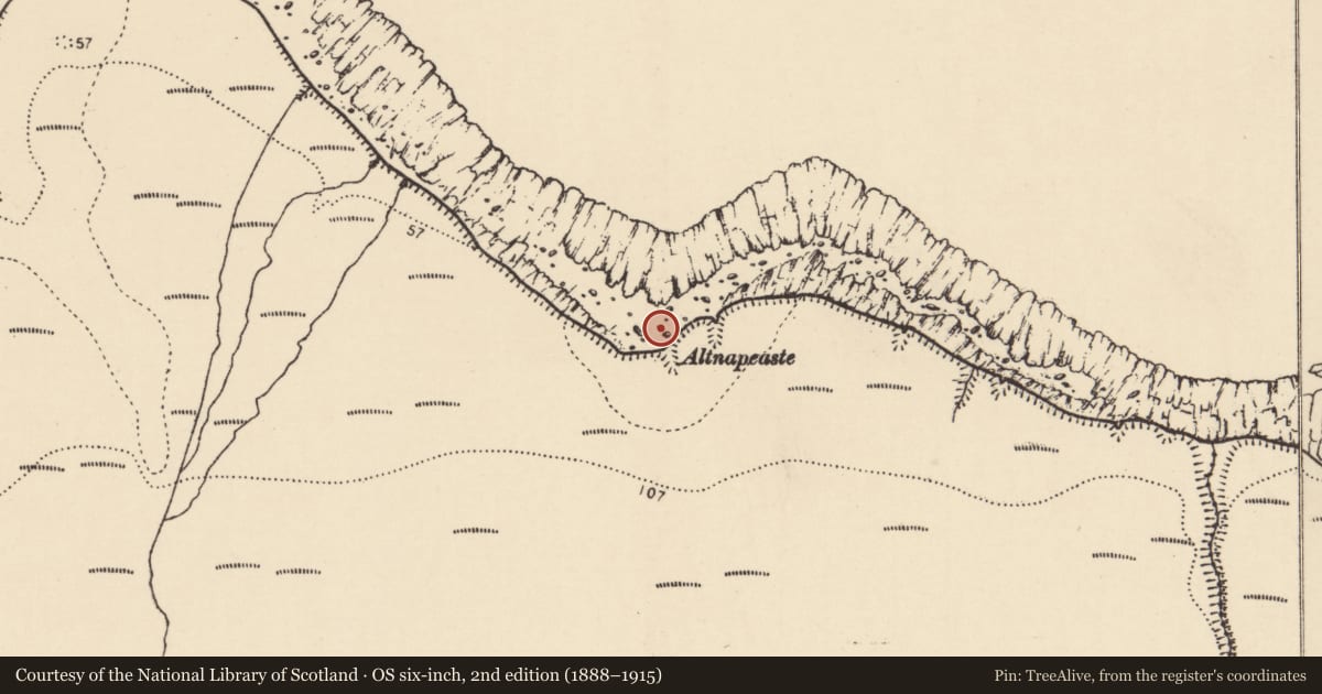
- Altnapeaste
- Coordinates
- 55.15487, -8.27274
- SMR number
- DG023-002----
Slide toward Today to fade the historical sheet and see the modern map underneath.
David Rumsey Map Collection, Stanford LibrariesDavid Rumsey Map Collection, Stanford LibrariesDavid Rumsey Map Collection, Stanford LibrariesDavid Rumsey Map Collection, Stanford Libraries
4 historical maps cover this location, the earliest the 1881 map "Ireland to Illustrate the Military Condition of the Country." (David Rumsey Map Collection, Stanford Libraries).
Historical maps covering this location
- 1881 · Ireland to Illustrate the Military Condition of the Country. (David Rumsey Map Collection, Stanford Libraries)
- 1891 · Ireland 16 (David Rumsey Map Collection, Stanford Libraries)
- 1900 · Ireland (David Rumsey Map Collection, Stanford Libraries)
- 1904 · Sheet 1. (David Rumsey Map Collection, Stanford Libraries)
This record in the National Monuments Service's Historic Environment Viewer ↗
The National Monuments Service's description
OS 23 (Precise location not discovered) 5. Described by Ó Muirgheasa in 1936 as 'There is a Holy Well under Cnoc Fola or Bloody Foreland. It has no name beyond Tobar Faoi Chnoc or Tobar Ailt na Peiste, but an occasional person still " walks " the turus. Twice each day the tide covers it, yet during ebb tide its water is said to be fresh. An old man over 100 years old never heard a saint's name on this well' (Ó Muirgheasa 1936, 152). (Ó Muirgheasa No. 51).
The above description was derived from the 'Archaeological Survey of County Donegal. A description of the field antiquities of the County from the Mesolithic Period to the 17th century.' Compiled by: Brian Lacey with Eamon Cody, Claire Cotter, Judy Cuppage, Noel Dunne, Vincent Hurley, Celie O'Rahilly, Paul Walsh and Seán Ó Nualláin (Lifford: Donegal County Council, 1983). In certain instances the entries have been revised and updated.
Compiled by Caimin O'Brien
Date of upload/revision: 02 November 2011
Nearby in the register
- Signal towerunder 1 mi
- Promontory fort - coastalunder 1 mi
- Field boundaryunder 1 mi
- Enclosureunder 1 mi
Other entries of the same register within about three miles of this one, by straight line.