Sites and Monuments Record · Ireland
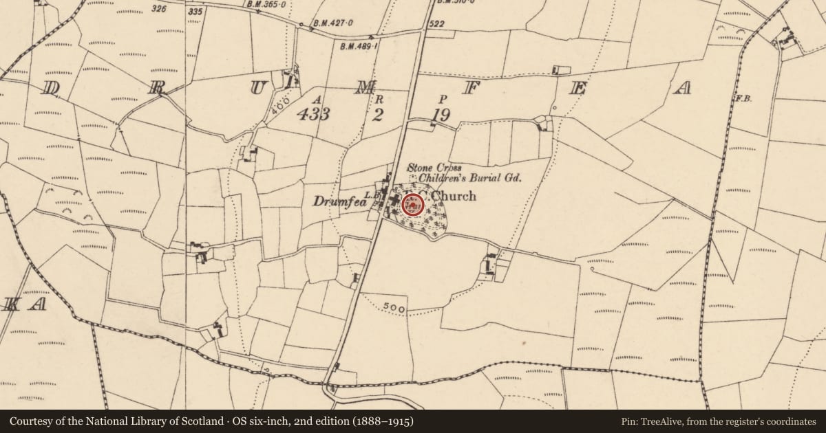
Church
Drumfea, County Carlow, Ireland
The record
- Townland
- Drumfea
- County
- Carlow
- Country
- Ireland
- First-edition OS map
- R.C. Chapel (in ruins), Stone Cross
- Latest-edition OS map
- Stone Cross, Childrens Burial Ground, Graveyard
- Coordinates
- 52.65903, -6.83898
- SMR number
- CW020-002001-
Slide toward Today to fade the historical sheet and see the modern map underneath.
David Rumsey Map Collection, Stanford LibrariesUniversity Library, Vrije Universiteit AmsterdamDavid Rumsey Map Collection, Stanford LibrariesDavid Rumsey Map Collection, Stanford Libraries
4 historical maps cover this location, the earliest the 1790 map "Composite: Ireland." (David Rumsey Map Collection, Stanford Libraries).
Historical maps covering this location
- 1790 · Composite: Ireland. (David Rumsey Map Collection, Stanford Libraries)
- 1869 · Ireland. (David Rumsey Map Collection, Stanford Libraries)
- 1891 · Ireland 16 (David Rumsey Map Collection, Stanford Libraries)
- 1904 · Sheet 14, 1904 (University Library, Vrije Universiteit Amsterdam)
This record in the National Monuments Service's Historic Environment Viewer ↗
The National Monuments Service's description
The following description is derived from the published 'Archaeological Inventory of County Carlow' (Dublin: Stationery Office, 1993). In certain instances the entries have been revised and updated in the light of recent research.
Date of revision: 22 December 2009
Revised by: J. Farrelly
Present remains consist of random coursed granite rubble of NE angle and adjacent walls standing to approximately full height in places. Foundations indicate rectangular structure (L 17.5m or 22m (W end obscured by eighteenth-century headstone) x Wth 6m). W splay of narrow ope close to NE corner. All quoins and ope surrounds missing. Rectangular granite font (CW020-002004-) with outlet beside corner. Children's burial ground (CW020-002002-) immediately N of graveyard (CW020-002005-), consisting of small unenclosed uncultivated rectangular area, marked by plain granite Latin cross (CW020-002003-), possibly of no great antiquity. (Comerford 1886, Vol III, 321; JRSAI 1907, 237)
References
Comerford, Rev. M. 1883-6 Collections relating to the dioceses of Kildare and Leighlin, 3 vols. James Duffy and Sons. Dublin.
Nearby in the register
- Fontunder 1 mi
- Children's burial groundunder 1 mi
- Crossunder 1 mi
- Graveyardunder 1 mi
Other entries of the same register within about three miles of this one, by straight line.