Sites and Monuments Record · Ireland
Castle - motte
Ballyknockan (Idrone West By.), County Carlow, Ireland
The record
- Townland
- Ballyknockan (Idrone West By.)
- County
- Carlow
- Country
- Ireland
- First-edition OS map
- Ballyknockan Moat
- Latest-edition OS map
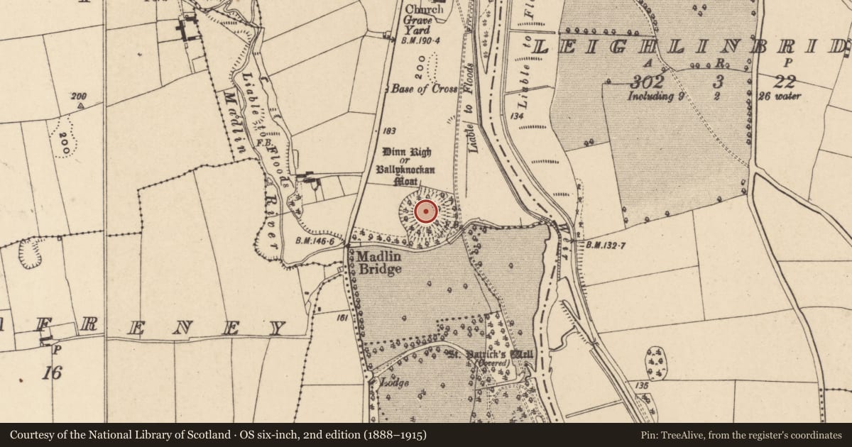
- Dinn Righ or Ballyknockan Moat
- Coordinates
- 52.72867, -6.98092
- SMR number
- CW016-003----
Slide toward Today to fade the historical sheet and see the modern map underneath.
David Rumsey Map Collection, Stanford LibrariesDavid Rumsey Map Collection, Stanford LibrariesDavid Rumsey Map Collection, Stanford LibrariesDavid Rumsey Map Collection, Stanford Libraries
4 historical maps cover this location, the earliest the 1790 map "Composite: Ireland." (David Rumsey Map Collection, Stanford Libraries).
Historical maps covering this location
- 1790 · Composite: Ireland. (David Rumsey Map Collection, Stanford Libraries)
- 1811 · Ireland. (David Rumsey Map Collection, Stanford Libraries)
- 1869 · Ireland. (David Rumsey Map Collection, Stanford Libraries)
- 1891 · Ireland 16 (David Rumsey Map Collection, Stanford Libraries)
This record in the National Monuments Service's Historic Environment Viewer ↗
The National Monuments Service's description
The following description is derived from the published 'Archaeological Inventory of County Carlow' (Dublin: Stationery Office, 1993). In certain instances the entries have been revised and updated in the light of recent research.
Date of upload/revision: 17 July 2007
Monument No. HM00318, this monument was entered in the Register of Historic Monuments on the 03 February 1960. Very large steep-sided flat-topped mound (H above fosse base at N c. 10m; summit diam. 38-40m) surrounded by large deep fosse (base Wth c. 3.5m) with large external bank except at W (H above base at N 5.7m; at E 3.3m; at S 1.2m). Situated at S end of gravel ridge and junction of two rivers to take maximum advantage of natural topography. Gaps in the bank at N and S probably modern. According to Giraldus Cambrensis, constructed in twelfth century (OKR 1985, 187-8). Price mentions discovery of skulls outside fosse and bank at N (Notebook 28, 1966, 26-9).
Aerial photograph (GB89.W.22) shows 'Dinn Righ' or 'Ballyknockan moat'
References
Price, L. 1928-66 Notebooks. OPW.
Nearby in the register
- Boundary stoneunder 1 mi
- Ritual site - holy wellunder 1 mi
- Graveyardunder 1 mi
- Churchunder 1 mi
Other entries of the same register within about three miles of this one, by straight line.