Sites and Monuments Record · Ireland
Castle - unclassified
Ballynunnery, County Carlow, Ireland
The record
- Townland
- Ballynunnery
- County
- Carlow
- Country
- Ireland
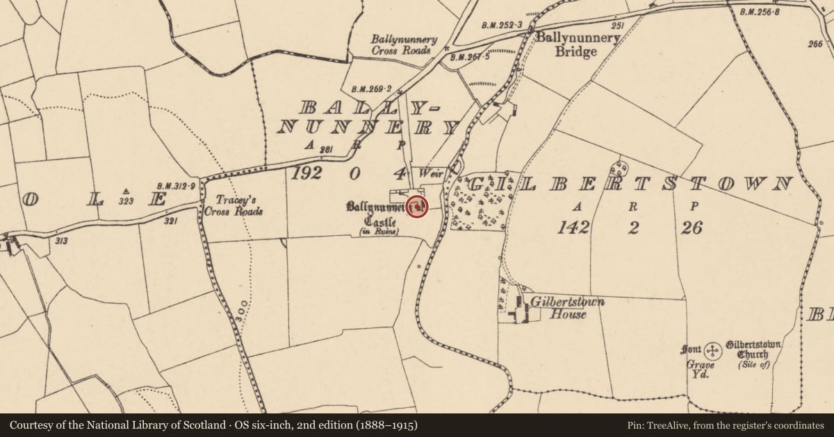
- First-edition OS map
- Ballynunnery Castle in ruins
- Latest-edition OS map
- Ballynunnery Castle (in Ruins)
- Coordinates
- 52.77239, -6.83081
- SMR number
- CW013-022----
Slide toward Today to fade the historical sheet and see the modern map underneath.
David Rumsey Map Collection, Stanford LibrariesDavid Rumsey Map Collection, Stanford LibrariesDavid Rumsey Map Collection, Stanford LibrariesDavid Rumsey Map Collection, Stanford Libraries
4 historical maps cover this location, the earliest the 1790 map "Composite: Ireland." (David Rumsey Map Collection, Stanford Libraries).
Historical maps covering this location
- 1790 · Composite: Ireland. (David Rumsey Map Collection, Stanford Libraries)
- 1811 · Ireland. (David Rumsey Map Collection, Stanford Libraries)
- 1869 · Ireland. (David Rumsey Map Collection, Stanford Libraries)
- 1891 · Ireland 16 (David Rumsey Map Collection, Stanford Libraries)
This record in the National Monuments Service's Historic Environment Viewer ↗
The National Monuments Service's description
The following description is derived from the published 'Archaeological Inventory of County Carlow' (Dublin: Stationery Office, 1993). In certain instances the entries have been revised and updated in the light of recent research.
Date of upload/revision: 17 July 2007
OS Namebooks record 'the ruins of a Castle … with part of one tower standing'. According to O'Toole (JKAS 1933, 301, 304-5) who includes a photograph, 'portion of the tower … is about 12 feet in height, and has walls 5 feet thick. Several of the out houses of the present farm house, seem to be have been portion of the out buildings of the Castle. In one there is a splayed window, which is 2 feet 10 inches wide inside, and narrows to 1 foot 8 inches on the outside; the wall is 3 feet thick'. Tower and some out houses have been levelled. Remains appear to belong to fairly substantial building. Down Survey (1655-6) map records castle and mill downstream (CW013-021----). Dineley's sketch of 1680 shows a complex of buildings including two tall square, gabled towers but no obvious signs of fortification (JRSAI 1862-3, 46-7).
Nearby in the register
- Graveyardunder 1 mi
- Churchunder 1 mi
- Barrow - mound barrowunder 1 mi
- Fontunder 1 mi
Other entries of the same register within about three miles of this one, by straight line.