Sites and Monuments Record · Ireland
Castle - Anglo-Norman masonry castle
Clonmore (Rathvilly By.), County Carlow, Ireland
The record
- Townland
- Clonmore (Rathvilly By.)
- County
- Carlow
- Country
- Ireland
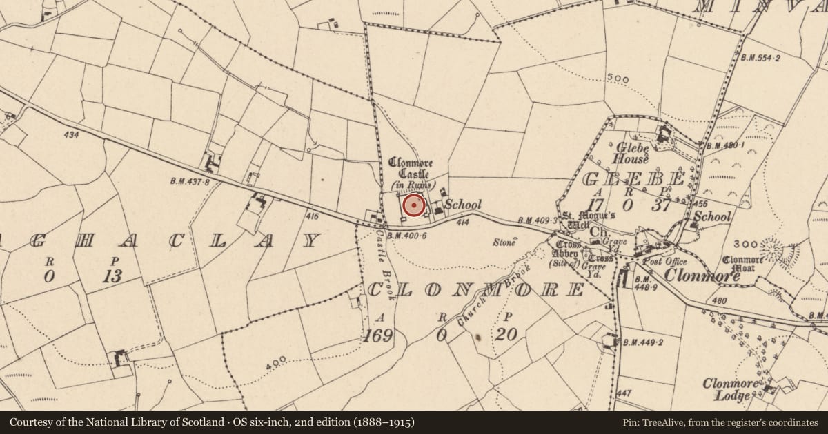
- Latest-edition OS map
- Clonmore Castle (in Ruins)
- Coordinates
- 52.82811, -6.57551
- SMR number
- CW009-026001-
Slide toward Today to fade the historical sheet and see the modern map underneath.
David Rumsey Map Collection, Stanford LibrariesDavid Rumsey Map Collection, Stanford LibrariesDavid Rumsey Map Collection, Stanford LibrariesDavid Rumsey Map Collection, Stanford Libraries
4 historical maps cover this location, the earliest the 1790 map "Composite: Ireland." (David Rumsey Map Collection, Stanford Libraries).
Historical maps covering this location
- 1790 · Composite: Ireland. (David Rumsey Map Collection, Stanford Libraries)
- 1799 · Ireland. (David Rumsey Map Collection, Stanford Libraries)
- 1830 · V.3:11-15:XV. Britisches Reich. C. Kon: Ireland. a. Prov: Leinster. Counties: 1-12 (David Rumsey Map Collection, Stanford Libraries)
- 1891 · Ireland 16 (David Rumsey Map Collection, Stanford Libraries)
This record in the National Monuments Service's Historic Environment Viewer ↗
The National Monuments Service's description
The following description is derived from the published 'Archaeological Inventory of County Carlow' (Dublin: Stationery Office, 1993). In certain instances the entries have been revised and updated in the light of recent research.
Date of upload/revision: 17 July 2007
Thirteenth-century fortress of roughly coursed granite rubble with extensive remodelling and additions. Originally square courtyard enclosed by curtain walls. Complex range of buildings subsequently developed at E side. No visible trace of S wall or gatehouse. Rectangular towers at SE, SW and NW angles and foundations of possible tower at NE. Enclosed by fosse at base of walls, visible now only at N and W, with outer fosse c. 40m to N. SE tower: modified and incorporated in E range of halls. Barrel-vaulted ground floor with two floors above. Large garderobe attached NE angle of tower. Cross loop and gargoyle at wall walk level. SW tower: barrel-vaulted ground floor, plus unknown number of upper floors. NW tower: badly damaged. Spiral stairs in NW leading to upper floors and wall walks. Garderobe chute exit on N wall. (Leask 1973, 72)
Nearby in the register
- Cross-slabunder 1 mi
- Bullaun stoneunder 1 mi
- Bullaun stone (present location)under 1 mi
- Ritual site - holy wellunder 1 mi
Other entries of the same register within about three miles of this one, by straight line.