Sites and Monuments Record · Ireland
Church
Kellistown East, County Carlow, Ireland
The record
- Townland
- Kellistown East
- County
- Carlow
- Country
- Ireland
- First-edition OS map
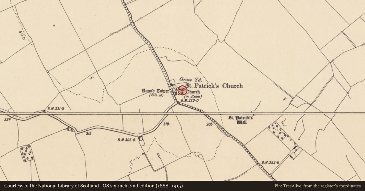
- Round Tower (site of), Church, Church (in ruins)
- Latest-edition OS map
- Round Tower (Site of), St. Patricks Church, Chur
- Coordinates
- 52.79223, -6.83198
- SMR number
- CW008-038001-
Slide toward Today to fade the historical sheet and see the modern map underneath.
David Rumsey Map Collection, Stanford LibrariesDavid Rumsey Map Collection, Stanford LibrariesDavid Rumsey Map Collection, Stanford LibrariesDavid Rumsey Map Collection, Stanford Libraries
4 historical maps cover this location, the earliest the 1790 map "Composite: Ireland." (David Rumsey Map Collection, Stanford Libraries).
Historical maps covering this location
- 1790 · Composite: Ireland. (David Rumsey Map Collection, Stanford Libraries)
- 1799 · Ireland. (David Rumsey Map Collection, Stanford Libraries)
- 1869 · Ireland. (David Rumsey Map Collection, Stanford Libraries)
- 1891 · Ireland 16 (David Rumsey Map Collection, Stanford Libraries)
This record in the National Monuments Service's Historic Environment Viewer ↗
The National Monuments Service's description
The following description is derived from the published 'Archaeological Inventory of County Carlow' (Dublin: Stationery Office, 1993). In certain instances the entries have been revised and updated in the light of recent research.
Date of revision: 16 December 2009
Revised by: J. Farrelly
In the S sector of the graveyard (CW008-038006-), the S wall of the church forming the S boundary of the graveyard. Dedicated to St Patrick (OSL 1839, 11-15, 100-1). Church consists of rectangular structure of large, uncoursed mortared granite boulders (min. L 14m; Wth 5.6m), subsequently enlarged and modified by removing and replacing wall at N to give width of 6.4m, adding chancel of small granite stones (min. L 5.3m; Wth c. 3.9m), and large round ashlar chancel arch. Blocked round-arched entrance in S wall of nave. Small piscina in S wall. Lying within nave are (1) large fragment of finely dressed polygonal font, (2) single basin bullaun (diam. 0.3m D 0.2m). No trace of round tower. (JKAS 1933, 271-7; JAPMD 1902, 148)
Nearby in the register
- Round towerunder 1 mi
- Fontunder 1 mi
- Bullaun stoneunder 1 mi
- Graveslabunder 1 mi
Other entries of the same register within about three miles of this one, by straight line.