Sites and Monuments Record · Ireland
Church
Clogrenan, County Carlow, Ireland
The record
- Townland
- Clogrenan
- County
- Carlow
- Country
- Ireland
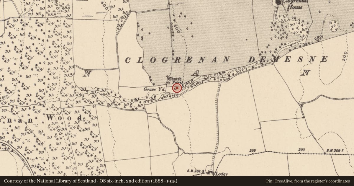
- First-edition OS map
- Church (in ruins), Graveyard
- Latest-edition OS map
- Church (in Ruins), Graveyard
- Coordinates
- 52.80347, -6.98140
- SMR number
- CW007-039001-
Slide toward Today to fade the historical sheet and see the modern map underneath.
David Rumsey Map Collection, Stanford LibrariesDavid Rumsey Map Collection, Stanford LibrariesDavid Rumsey Map Collection, Stanford LibrariesDavid Rumsey Map Collection, Stanford Libraries
4 historical maps cover this location, the earliest the 1790 map "Composite: Ireland." (David Rumsey Map Collection, Stanford Libraries).
Historical maps covering this location
- 1790 · Composite: Ireland. (David Rumsey Map Collection, Stanford Libraries)
- 1811 · Ireland. (David Rumsey Map Collection, Stanford Libraries)
- 1869 · Ireland. (David Rumsey Map Collection, Stanford Libraries)
- 1891 · Ireland 16 (David Rumsey Map Collection, Stanford Libraries)
This record in the National Monuments Service's Historic Environment Viewer ↗
The National Monuments Service's description
The following description is derived from the published 'Archaeological Inventory of County Carlow' (Dublin: Stationery Office, 1993). In certain instances the entries have been revised and updated in the light of recent research.
Date of revision: 16 December 2009
Revised by: J. Farrelly
In the NE sector of a rectangular graveyard (CW007-039003-). Undifferentiated late medieval parish church of Cloydagh. According to ITA Survey (1945), church attached to Augustinian Monastery of Great Connall, Co. Kildare. Remains consist of rectangular church (ext dims. 19.3m x 7.10m), of limestone rubble with granite quoins. Church has opposed N and S doorways and late medieval window with pointed arch of chamfered granite. Plain window in S wall of chancel. May incorporate parts of earlier structure, suggested by blocked narrow lintelled ope in N wall close to W end. Door in S wall formerly included face mask with bulbous features (possibly modern) on W jamb; arch and jamb now removed. Piscina with moulded granite surround at E end of S wall. Incorporated in W gable is stone with incised cross, of pre-Norman date.
Nearby in the register
- Cross-inscribed stoneunder 1 mi
- Graveyardunder 1 mi
- Enclosureunder 1 mi
- Earthworkunder 1 mi
Other entries of the same register within about three miles of this one, by straight line.