Sites and Monuments Record · Ireland
Enclosure
Rainestown, County Carlow, Ireland
The record
- Townland
- Rainestown
- County
- Carlow
- Country
- Ireland
- First-edition OS map
- Not indicated
- Latest-edition OS map
- Not indicated
- Coordinates
- 52.86151, -6.82583
- SMR number
- CW003-024004-
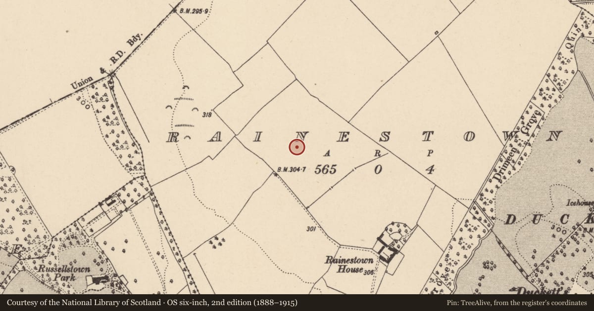
Slide toward Today to fade the historical sheet and see the modern map underneath.
David Rumsey Map Collection, Stanford LibrariesDavid Rumsey Map Collection, Stanford LibrariesDavid Rumsey Map Collection, Stanford LibrariesDavid Rumsey Map Collection, Stanford Libraries
4 historical maps cover this location, the earliest the 1790 map "Composite: Ireland." (David Rumsey Map Collection, Stanford Libraries).
Historical maps covering this location
- 1790 · Composite: Ireland. (David Rumsey Map Collection, Stanford Libraries)
- 1799 · Ireland. (David Rumsey Map Collection, Stanford Libraries)
- 1830 · V.3:11-15:XV. Britisches Reich. C. Kon: Ireland. a. Prov: Leinster. Counties: 1-12 (David Rumsey Map Collection, Stanford Libraries)
- 1891 · Ireland 16 (David Rumsey Map Collection, Stanford Libraries)
This record in the National Monuments Service's Historic Environment Viewer ↗
The National Monuments Service's description
Aerial photograph (GB89.AG.26) shows cropmark of a complex landscape comprising conjoined circular and rectangular enclosures and an associated field system.
The enclosures extend from NW to SE and consist of a large but incomplete circular enclosure defined by two concentric fosses (inner fosse visible as complete on aerial photograph GB20.GL.31) (CW003-024002-); a large circular enclosure defined by two concentric widely spaced fosses (CW003-024003-); an incomplete rectilinear enclosure (with rounded corners) defined by two fosses (CW003-024004-); an incomplete rectangular enclosure defined by two fosses (CW003-024005-); an irregular enclosure defined by a fosse (CW003-026----) and a circular enclosure defined by a fosse (CW003-027----). An associated field system extends S from the enclosures (CW003-024001-).
Bibliography
Barrett, G.F. 'Early landscapes in County Carlow: an aerial perspective, in T. McGrath and T. O'Keefe (eds), County Carlow: History and Society, Geography Publications, Dublin. Forthcoming 2008.
Barrett, G.F. (1999) 'Relevé aérien d'archéologie en Irlande, in Archeologie Aerienne: Actes du colloque du festival international d'archéologie d'Amiens. Revue archaeologie de Picardie special 17/1999. APPAH Ministère de la culture, Amiens et de l'Université de Picardie, pp. 245-52. ISSN 0752-5656 .
Barrett, G.F. (1996) 'Archaeological air survey in County Carlow: discovery and destruction' Carloviana, 44, pp. 16-22.
Barrett, G.F. (1995) 'Recovering the hidden archaeology of Ireland: the impact of aerial survey in the River Barrow valley, 1989-91” in O. Braasch, and G. Wetzel, G. (eds), Aerial Archaeology in eastern and central Europe, 45-59, Proceedings of the Kleinmachnow conference, Brandenburg Museum, Potsdam, pp.45-59. ISBN 3-910011-08-X.
Compiled by: Dr. Gillian Barrett and Claire Breen for the Archaeological Survey of Ireland.
Date of revision: 16 March 2012
Nearby in the register
- Enclosureunder 1 mi
- Field systemunder 1 mi
- Enclosureunder 1 mi
- Enclosureunder 1 mi
Other entries of the same register within about three miles of this one, by straight line.