Sites and Monuments Record · Ireland
Megalithic tomb - portal tomb
Ballaghanea, County Cavan, Ireland
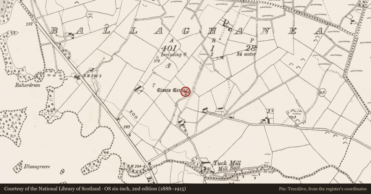
The record
- Townland
- Ballaghanea
- County
- Cavan
- Country
- Ireland
- Latest-edition OS map
- Giants Grave
- Coordinates
- 53.82480, -7.05275
- SMR number
- CV039-012----
Slide toward Today to fade the historical sheet and see the modern map underneath.
David Rumsey Map Collection, Stanford LibrariesDavid Rumsey Map Collection, Stanford LibrariesDavid Rumsey Map Collection, Stanford LibrariesDavid Rumsey Map Collection, Stanford Libraries
4 historical maps cover this location, the earliest the 1636 map "Vltoniae Orientalis Pars" (David Rumsey Map Collection, Stanford Libraries).
Historical maps covering this location
- 1636 · Vltoniae Orientalis Pars (David Rumsey Map Collection, Stanford Libraries)
- 1790 · Composite: Ireland. (David Rumsey Map Collection, Stanford Libraries)
- 1869 · Ireland. (David Rumsey Map Collection, Stanford Libraries)
- 1891 · Ireland 16 (David Rumsey Map Collection, Stanford Libraries)
This record in the National Monuments Service's Historic Environment Viewer ↗
The National Monuments Service's description
Situated in rolling land 300m NE of Lough Ramor. In the mid-1960s, when the published plan was made (de Valera and Ó Nualláin 1972), this tomb, incorporated in a field fence, was quite ruined. It consisted of the remains of a gallery, 2.2m long, aligned SSE-NNW. A stone 1.3m high, seemed to mark the N end of the gallery. Three orthostats formed its more easterly side, the tallest 0.8m high. Opposite these a displaced slab protruded from the fence. The remains appeared to be those of a portal tomb. Some fifteen years ago the tomb was considerably damaged, however some structure still remains. (de Valera and Ó Nualláin 1972, 135-6, No. 39)
The above description is derived from the published 'Archaeological Inventory of County Cavan' (Dublin: Stationery Office, 1995). In certain instances the entries have been revised and updated in the light of recent research.
Date of upload/revision: 22 December 2008
See linked document with details from Ruaidhrí de Valera and Seán Ó Nualláin, Survey of the Megalithic Tombs of Ireland. Volume III. Counties Galway, Roscommon, Leitrim, Longford, Westmeath, Laoighis, Offaly, Kildare, Cavan. (Dublin: Stationery Office, 1972).
Nearby in the register
- Memorial stoneunder 1 mi
- Ringfort - rathunder 1 mi
- Ringfort - rathunder 1 mi
- Castle - unclassifiedunder 1 mi
Other entries of the same register within about three miles of this one, by straight line.