Sites and Monuments Record · Ireland
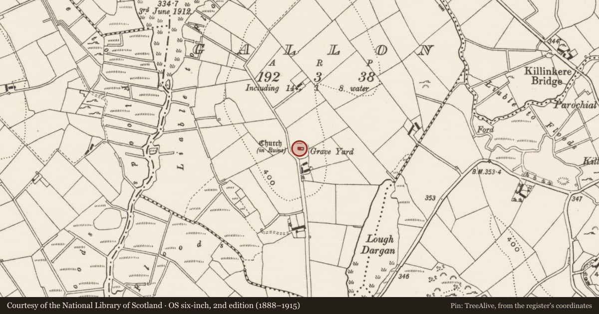
Church
Gallon, County Cavan, Ireland
The record
- Townland
- Gallon
- County
- Cavan
- Country
- Ireland
- First-edition OS map
- Church
- Latest-edition OS map
- Church (in Ruins)
- Coordinates
- 53.88577, -7.08426
- SMR number
- CV033-031001-
Slide toward Today to fade the historical sheet and see the modern map underneath.
David Rumsey Map Collection, Stanford LibrariesDavid Rumsey Map Collection, Stanford LibrariesDavid Rumsey Map Collection, Stanford LibrariesDavid Rumsey Map Collection, Stanford Libraries
4 historical maps cover this location, the earliest the 1636 map "Vltoniae Orientalis Pars" (David Rumsey Map Collection, Stanford Libraries).
Historical maps covering this location
- 1636 · Vltoniae Orientalis Pars (David Rumsey Map Collection, Stanford Libraries)
- 1790 · Composite: Ireland. (David Rumsey Map Collection, Stanford Libraries)
- 1869 · Ireland. (David Rumsey Map Collection, Stanford Libraries)
- 1891 · Ireland 16 (David Rumsey Map Collection, Stanford Libraries)
This record in the National Monuments Service's Historic Environment Viewer ↗
The National Monuments Service's description
Located towards the top of the E and S-facing slope of a drumlin. The parish church of Killinkere is conserved within a subcircular graveyard (dims c. 52m E-W; c. 42m N-S) defined by a drystone wall which is replaced by a masonry wall where it borders a farm lane S-W. The graveyard has headstones dating from c. 1720 to c. 1960 including a fine collection of eighteenth century slate headstones. Kilinkerre was one of the parishes impropriate to the Benedictine abbey of Fore (WM004-035010-) (Kelly 2017, 76), and the church is first mentioned in 1406 (Davies 1948, 98). The remains consist of the foundations of a rectangular structure (ext. dims 18.55m E-W; 8m N-S; int. dims 12.55m E-W; 5.95m N-S) defined by the foundations of external walls (Wth c. 1m; int. H 0.2-0.8m). No doorways or other architectural features are present, apart from evidence of a mausoleum (int. dims 5.9m N-S; 3.15m E-W) separated from the nave by cross-wall at its W end. The conserved W gable survives entire with a small window beneath the apex, and the springing of the vault of the mausoleum is evident on the inner face of the wall. A face corbel is now built into the gable below the window embrasure.
The above description is derived from the published 'Archaeological Inventory of County Cavan' (Dublin: Stationery Office, 1995). In certain instances the entries have been revised and updated in the light of recent research.
Date of upload: 22 December 2008
Revised by: Michael Moore
Date of revised upload; 18 March 2020
References
Davies, O. 1948 The churches of county Cavan. Journal of the Royal Society of Antiquaries of Ireland 78, 73-118.
Kelly, L. 2017 The Diocese of Kilmore c. 1100-1800. Dublin, Columba Press
Nearby in the register
- Mausoleumunder 1 mi
- Graveyardunder 1 mi
- Ritual site - holy wellunder 1 mi
- Crossunder 1 mi
Other entries of the same register within about three miles of this one, by straight line.