Sites and Monuments Record · Ireland
Church
Crosserlough, County Cavan, Ireland
The record
- Townland
- Crosserlough
- County
- Cavan
- Country
- Ireland
- First-edition OS map
- Not indicated
- Latest-edition OS map
- Not indicated
- Coordinates
- 53.87548, -7.29038
- SMR number
- CV032-007001-
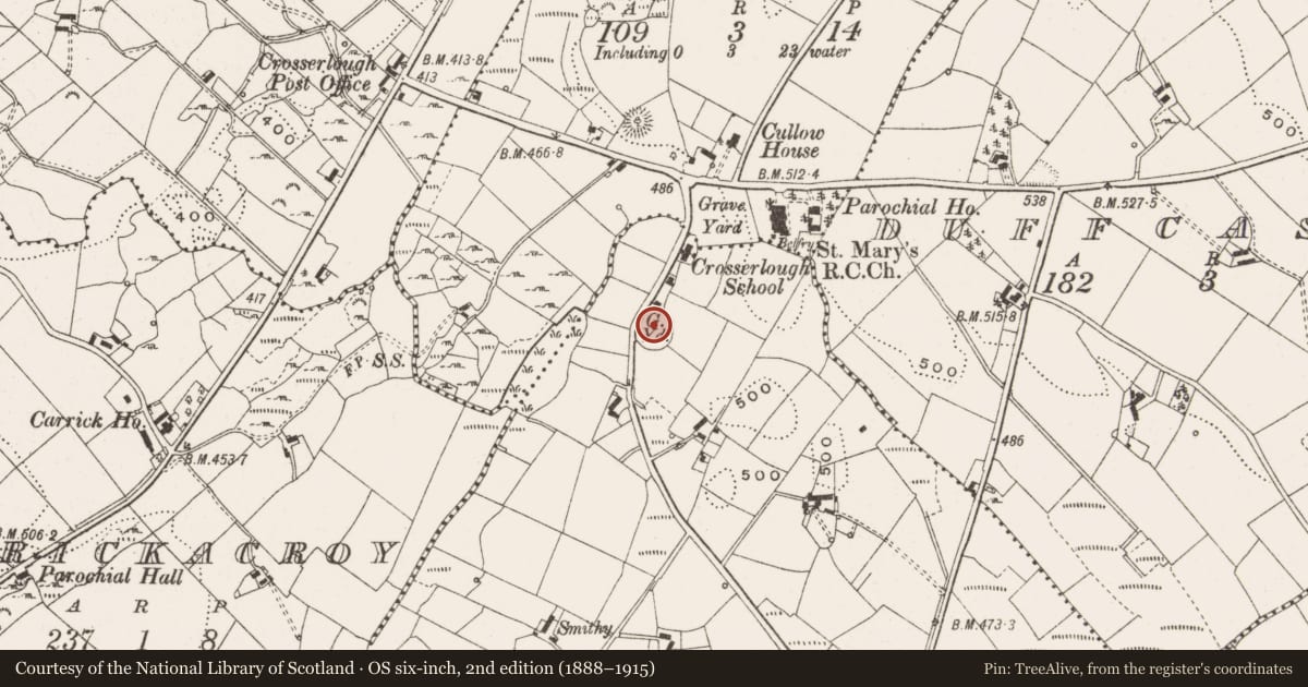
Slide toward Today to fade the historical sheet and see the modern map underneath.
David Rumsey Map Collection, Stanford LibrariesDavid Rumsey Map Collection, Stanford LibrariesDavid Rumsey Map Collection, Stanford LibrariesDavid Rumsey Map Collection, Stanford Libraries
4 historical maps cover this location, the earliest the 1636 map "Vltoniae Orientalis Pars" (David Rumsey Map Collection, Stanford Libraries).
Historical maps covering this location
- 1636 · Vltoniae Orientalis Pars (David Rumsey Map Collection, Stanford Libraries)
- 1790 · Composite: Ireland. (David Rumsey Map Collection, Stanford Libraries)
- 1869 · Ireland. (David Rumsey Map Collection, Stanford Libraries)
- 1891 · Ireland 16 (David Rumsey Map Collection, Stanford Libraries)
This record in the National Monuments Service's Historic Environment Viewer ↗
The National Monuments Service's description
Located on a knoll towards the top of a W-facing slope. This is the parish church of Crosserlough parish, known as Kildrumferton during the Middle Ages when a portion of its tithes were impropriate to the Benedictine abbey of Fore (WM004-035010-) (Kelly 2017, 76). It is identified as the church of SS Patrick Carhac and St Bridget with references in 1422 and 1425 (Davies 1948, 81). The outline of a rectangular structure (int. dims 19.2m E-W; 7m N-S) in interrupted sections of low grass-covered walls (Wth 0.9m; max. H 0.6m) can barely be discerned within a circular graveyard (diam. c. 54m NE-SW; c. 50m NW-SE). The graveyard is defined by a drystone wall (at E: Wth 1m; int. H 0.6m; ext. H 1.4m) with mature deciduous trees and material accumulated against its inner face. A masonry wall retains the rising mound of the neglected graveyard along the roadside SW-NW. There are relatively few headstones, dating largely to the nineteenth and early twentieth centuries.
The above description is derived from the published 'Archaeological Inventory of County Cavan' (Dublin: Stationery Office, 1995). In certain instances the entries have been revised and updated in the light of recent research.
Date of upload: 22 December 2008
Revised by: Michael Moore
Date of revised upload: 16 March 2020
References
Davies, O. 1948 The churches of county Cavan. Journal of the Royal Society of Antiquaries of Ireland 78, 73-118.
Kelly, L. 2017 The Diocese of Kilmore c. 1100-1800. Dublin, Columba Press
Nearby in the register
- Graveyardunder 1 mi
- Ringfort - rathunder 1 mi
- Enclosureunder 1 mi
- Ringfort - rathunder 1 mi
Other entries of the same register within about three miles of this one, by straight line.