Sites and Monuments Record · Ireland
Crannog
Rivory, County Cavan, Ireland
The record
- Townland
- Rivory
- County
- Cavan
- Country
- Ireland
- First-edition OS map
- NULL
- Latest-edition OS map
- Indicated
- Coordinates
- 54.04537, -7.42874
- SMR number
- CV015-060----
Slide toward Today to fade the historical sheet and see the modern map underneath.
David Rumsey Map Collection, Stanford LibrariesDavid Rumsey Map Collection, Stanford LibrariesDavid Rumsey Map Collection, Stanford LibrariesDavid Rumsey Map Collection, Stanford Libraries
4 historical maps cover this location, the earliest the 1636 map "Vltoniae Orientalis Pars" (David Rumsey Map Collection, Stanford Libraries).
Historical maps covering this location
- 1636 · Vltoniae Orientalis Pars (David Rumsey Map Collection, Stanford Libraries)
- 1790 · Composite: Ireland. (David Rumsey Map Collection, Stanford Libraries)
- 1869 · Ireland. (David Rumsey Map Collection, Stanford Libraries)
- 1891 · Ireland 16 (David Rumsey Map Collection, Stanford Libraries)
This record in the National Monuments Service's Historic Environment Viewer ↗
The National Monuments Service's description
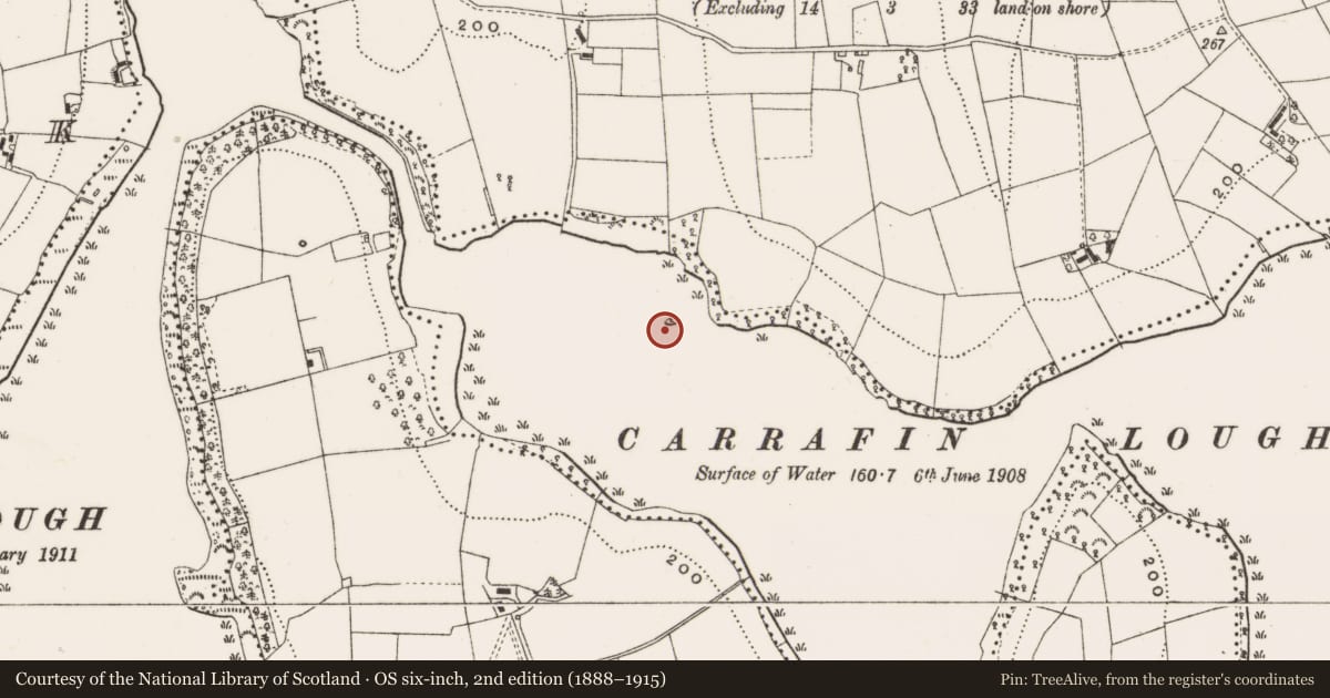
Situated in deep water in Carrafin Lough, c. 45m from the shoreline. Excavated by Davies in 1938. He found (Davies 1942, 28-9) that the core of the island was a natural gravel ridge running N-S which was considerably extended E and W with logs and stones. On the exposed W side of the island Davies found a well-preserved stone kerb and at E three visible layers of radial logs with cross-logs between, and on top of this structure a criss-cross log-floor with some stones. Finds from the crannóg included burnt animal bone, teeth, hazelnuts, decorated sherds of pottery, querns, a stone axe, a single-bladed iron axe with socket-hole, a hollowed pebble, a 'fairly recent' brass spur and two ring-headed pins. Local tradition maintains that this was the first stronghold of Owen Roe O'Neill, which he later abandoned for Clogh Oughter Castle (CV020-060----).
The above description is derived from the published 'Archaeological Inventory of County Cavan' (Dublin: Stationery Office, 1995). In certain instances the entries have been revised and updated in the light of recent research.
Date of upload/revision: 22 December 2008
Nearby in the register
- Moated siteunder 1 mi
- Crannogunder 1 mi
- Crannogunder 1 mi
- Enclosureunder 1 mi
Other entries of the same register within about three miles of this one, by straight line.