Sites and Monuments Record · Ireland
Megalithic tomb - unclassified
Drummany (Upper Loughtee By.), County Cavan, Ireland
The record
- Townland
- Drummany (Upper Loughtee By.)
- County
- Cavan
- Country
- Ireland
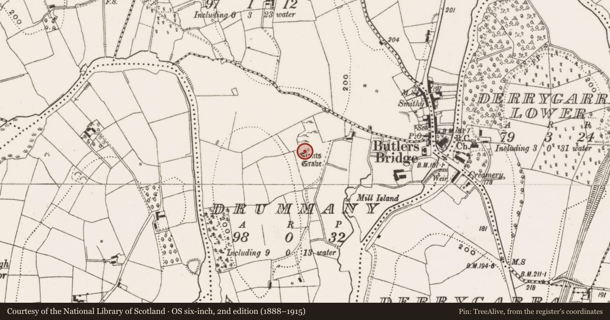
- Latest-edition OS map
- Giants Grave
- Coordinates
- 54.04307, -7.38222
- SMR number
- CV015-040----
Slide toward Today to fade the historical sheet and see the modern map underneath.
David Rumsey Map Collection, Stanford LibrariesDavid Rumsey Map Collection, Stanford LibrariesDavid Rumsey Map Collection, Stanford LibrariesDavid Rumsey Map Collection, Stanford Libraries
4 historical maps cover this location, the earliest the 1636 map "Vltoniae Orientalis Pars" (David Rumsey Map Collection, Stanford Libraries).
Historical maps covering this location
- 1636 · Vltoniae Orientalis Pars (David Rumsey Map Collection, Stanford Libraries)
- 1790 · Composite: Ireland. (David Rumsey Map Collection, Stanford Libraries)
- 1869 · Ireland. (David Rumsey Map Collection, Stanford Libraries)
- 1891 · Ireland 16 (David Rumsey Map Collection, Stanford Libraries)
This record in the National Monuments Service's Historic Environment Viewer ↗
The National Monuments Service's description
Sited on a slight rise close to the village of Butler's Bridge. A gallery, open at both ends and orientated NNW-SSE, is 6m long and 1.6m wide. Five contiguous stones form the E side but only one orthostat remains on the opposite side. The northern stone at E, 1.95m high, is 0.5m or more taller than the other stones. The southern stone at E is skewed inward suggesting that the gallery may have ended here. There are three prostrate stones at the site. (de Valera and Ó Nualláin 1972, 118-9, No. 18)
The above description is derived from the published 'Archaeological Inventory of County Cavan' (Dublin: Stationery Office, 1995). In certain instances the entries have been revised and updated in the light of recent research.
Date of upload/revision: 22 December 2008
See linked document with details from Ruaidhrí de Valera and Seán Ó Nualláin, Survey of the Megalithic Tombs of Ireland. Volume III. Counties Galway, Roscommon, Leitrim, Longford, Westmeath, Laoighis, Offaly, Kildare, Cavan. (Dublin: Stationery Office, 1972).
Nearby in the register
- Fulacht fiaunder 1 mi
- Standing stoneunder 1 mi
- Ringfort - rathunder 1 mi
- Ringfort - rathunder 1 mi
Other entries of the same register within about three miles of this one, by straight line.