Sites and Monuments Record · Ireland
Megalithic tomb - wedge tomb
Aughrim, County Cavan, Ireland
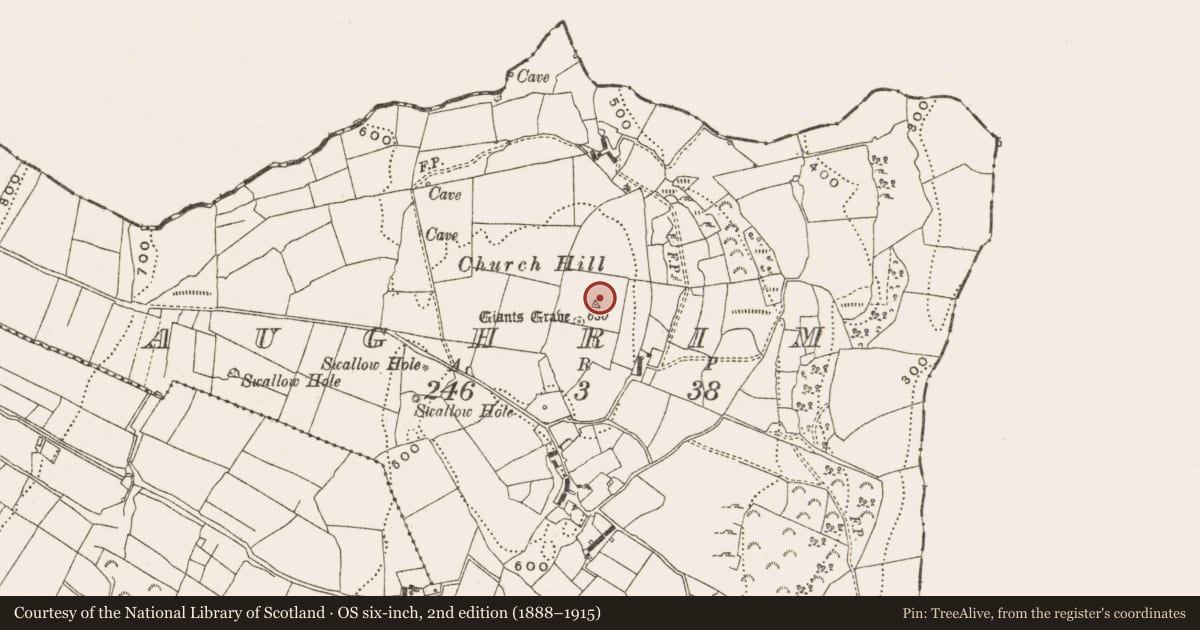
The record
- Townland
- Aughrim
- County
- Cavan
- Country
- Ireland
- Latest-edition OS map
- Giants Grave
- Coordinates
- 54.13898, -7.58220
- SMR number
- CV010-005----
Slide toward Today to fade the historical sheet and see the modern map underneath.
David Rumsey Map Collection, Stanford LibrariesDavid Rumsey Map Collection, Stanford LibrariesDavid Rumsey Map Collection, Stanford LibrariesDavid Rumsey Map Collection, Stanford Libraries
4 historical maps cover this location, the earliest the 1790 map "Composite: Ireland." (David Rumsey Map Collection, Stanford Libraries).
Historical maps covering this location
- 1790 · Composite: Ireland. (David Rumsey Map Collection, Stanford Libraries)
- 1869 · Ireland. (David Rumsey Map Collection, Stanford Libraries)
- 1891 · Ireland 16 (David Rumsey Map Collection, Stanford Libraries)
- 1904 · Sheet 4. (David Rumsey Map Collection, Stanford Libraries)
This record in the National Monuments Service's Historic Environment Viewer ↗
The National Monuments Service's description
Originally sited on Church Hill at the SE flank of Slieve Rushen, this tomb was excavated in 1992 in advance of quarrying operations and re-erected in the grounds of the Slieve Russell Hotel near Ballyconnell (see CV014-060----). It consists of a ruined gallery, some 6m long, aligned WSW-ENE, set in a low, round cairn, retained by a kerb. A tall stone at W, splits the entry to the gallery which seems to have been divided into a short portico and main chamber. There are buttress stones along both sides of the gallery. During the excavation both inhumed and cremated bone, in association with beaker and food-vessel pottery, were recovered from below the cairn and inside the gallery under a rough paving. Three cist burials were found at the inner edge of the kerb. (de Valera and Ó Nualláin 1972, 115-6, No. 14; Channing 1992, 4)
The above description is derived from the published 'Archaeological Inventory of County Cavan' (Dublin: Stationery Office, 1995). In certain instances the entries have been revised and updated in the light of recent research.
Date of upload/revision: 24 August 2010
See linked document with details from Ruaidhrí de Valera and Seán Ó Nualláin, Survey of the Megalithic Tombs of Ireland. Volume III. Counties Galway, Roscommon, Leitrim, Longford, Westmeath, Laoighis, Offaly, Kildare, Cavan. (Dublin: Stationery Office, 1972).
This monument is subject to a preservation order made under the National Monuments Acts 1930 to 2014 (PO no. 2/1987).
Nearby in the register
- Ringfort - unclassified1 mi
- Megalithic tomb - court tomb1 mi
- Barrow - unclassified1 mi
- Ringfort - rath1 mi
Other entries of the same register within about three miles of this one, by straight line.