Sites and Monuments Record · Ireland
Bawn
Bawnboy, County Cavan, Ireland
The record
- Townland
- Bawnboy
- County
- Cavan
- Country
- Ireland
- First-edition OS map
- Not indicated
- Latest-edition OS map
- Not indicated
- Coordinates
- 54.12534, -7.67364
- SMR number
- CV009-003----
Slide toward Today to fade the historical sheet and see the modern map underneath.
David Rumsey Map Collection, Stanford LibrariesDavid Rumsey Map Collection, Stanford LibrariesDavid Rumsey Map Collection, Stanford LibrariesDavid Rumsey Map Collection, Stanford Libraries
4 historical maps cover this location, the earliest the 1790 map "Composite: Ireland." (David Rumsey Map Collection, Stanford Libraries).
Historical maps covering this location
- 1790 · Composite: Ireland. (David Rumsey Map Collection, Stanford Libraries)
- 1869 · Ireland. (David Rumsey Map Collection, Stanford Libraries)
- 1891 · Ireland 16 (David Rumsey Map Collection, Stanford Libraries)
- 1904 · Sheet 4. (David Rumsey Map Collection, Stanford Libraries)
This record in the National Monuments Service's Historic Environment Viewer ↗
The National Monuments Service's description
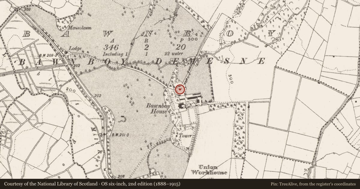
Corrasmongan was an estate of two portions, each consisting of 1000 acres, granted to Sir Richard and George Grimes in the Plantation. They died in 1626 and 1624 respectively and were succeeded by their sons, Thomas and William, the latter taking over the Cavan portions of an estate that included land in Co. Laois, and he made Bawnboy the centre for Cavan (Davies 1948a, 121). All that survives are the remains of a featureless D-shaped or open-backed tower (int. diam. 5m N-S) built of uncoursed rubble masonry with modern building attached that may be the NW angle of a bawn. (Wilsdon 2010, 182-4)
The above description is derived from the published 'Archaeological Inventory of County Cavan' (Dublin: Stationery Office, 1995). In certain instances the entries have been revised and updated in the light of recent research.
Date of revision: 13 April, 2016
References
Wilsdon, B. 2010 Plantation Castles on the Erne. The History Press, Dublin
Davies, O. 1948 The castles of county Cavan, Part 2. Ulster Journal of Archaeology 11, 80-126.
Nearby in the register
- Structureunder 1 mi
- Ringfort - rathunder 1 mi
- Architectural fragment1 mi
- Crannog1 mi
Other entries of the same register within about three miles of this one, by straight line.