Sites and Monuments Record · Ireland
Megalithic tomb - wedge tomb
Slievemore (Sherkin Island), County Cork, Ireland
The record
- Townland
- Slievemore (Sherkin Island)
- County
- Cork
- Country
- Ireland
- Latest-edition OS map
- Not indicated
- Coordinates
- 51.46271, -9.43747
- SMR number
- CO153-001003-
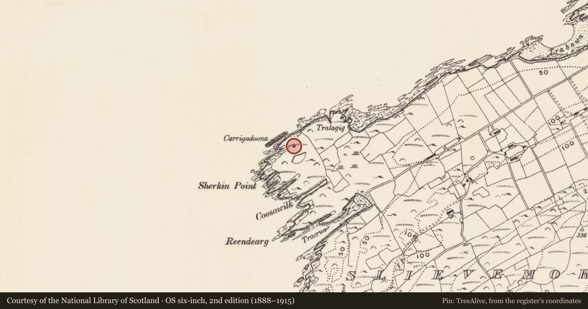
Slide toward Today to fade the historical sheet and see the modern map underneath.
David Rumsey Map Collection, Stanford LibrariesDavid Rumsey Map Collection, Stanford LibrariesDavid Rumsey Map Collection, Stanford LibrariesDavid Rumsey Map Collection, Stanford Libraries
4 historical maps cover this location, the earliest the 1841 map "Ireland." (David Rumsey Map Collection, Stanford Libraries).
Historical maps covering this location
- 1841 · Ireland. (David Rumsey Map Collection, Stanford Libraries)
- 1866 · Ireland. (David Rumsey Map Collection, Stanford Libraries)
- 1868 · 4. Ireland. (David Rumsey Map Collection, Stanford Libraries)
- 1882 · Ireland (southern half). (David Rumsey Map Collection, Stanford Libraries)
This record in the National Monuments Service's Historic Environment Viewer ↗
The National Monuments Service's description
Situated on a terrace at the head of a narrow inlet, immediately E of Carrigdoona promontory fort (CO153-001001-) and close to Sherkin Point. It consists of a chamber (L 2.6m, Wth 1.1m) open to SW which is represented by one sidestone to N, two sidestones to S with an inset backstone to E. A low transverse stone set outside the W end of the S sidestone may represent some form of entrance feature, or part of a facade. Slight traces of a possible mound are visible to the N of the chamber. This monument was severely damaged during the winter storms of 2013-14 and has been enveloped by the rock pool which, when surveyed in 1988, was then just a small hole at the NW end of the chamber (see attached plan, CO153-001003-_01.pdf). (Power et al. 1992, no. 36)
The attached image (CO153-001003-_01.jpg) was taken in April 2009 and is uploaded courtesy of Dolly O'Reilly.
Compiled by: Paul Walsh
Date of upload: 18 August 2014
References
Power, D., Byrne, E., Egan, U., Lane, S. and Sleeman, M. 1992 (Reprint 2003) Archaeological inventory of county Cork, vol. 1: West Cork. Dublin. Stationery Office.
Nearby in the register
- Promontory fort - coastalunder 1 mi
- Hut siteunder 1 mi
- Standing stoneunder 1 mi
- Enclosureunder 1 mi
Other entries of the same register within about three miles of this one, by straight line.