Sites and Monuments Record · Ireland
Bawn
Toehead, County Cork, Ireland
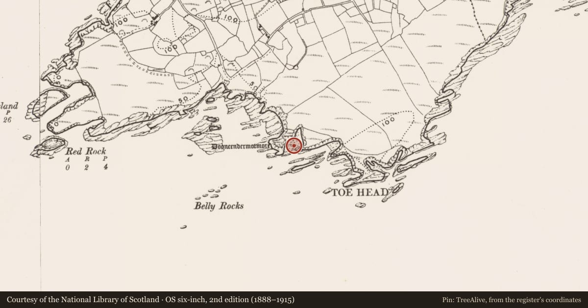
The record
- Townland
- Toehead
- County
- Cork
- Country
- Ireland
- First-edition OS map
- NULL
- Latest-edition OS map
- NULL
- Coordinates
- 51.48191, -9.23199
- SMR number
- CO151-053001-
Slide toward Today to fade the historical sheet and see the modern map underneath.
David Rumsey Map Collection, Stanford LibrariesDavid Rumsey Map Collection, Stanford LibrariesDavid Rumsey Map Collection, Stanford LibrariesDavid Rumsey Map Collection, Stanford Libraries
4 historical maps cover this location, the earliest the 1841 map "Ireland." (David Rumsey Map Collection, Stanford Libraries).
Historical maps covering this location
- 1841 · Ireland. (David Rumsey Map Collection, Stanford Libraries)
- 1866 · Ireland. (David Rumsey Map Collection, Stanford Libraries)
- 1868 · 4. Ireland. (David Rumsey Map Collection, Stanford Libraries)
- 1882 · Ireland (southern half). (David Rumsey Map Collection, Stanford Libraries)
This record in the National Monuments Service's Historic Environment Viewer ↗
The National Monuments Service's description
Subrectangular area projecting S into Atlantic; connected to mainland by narrow neck with V-shaped profile. Excavations by O'Kelly (1952, 35-54) showed that fosse of early defences (CO151-040---) re-cut in late medieval times when headland re-fortified. At neck stone causeway constructed on landward side of fosse; according to O'Kelly wooden drawbridge linked causeway to interior. Along edge of promontory sections of curtain wall survived, particularly to N, with opening corresponding to causeway. On S side of enclosure O'Kelly uncovered lower courses of rectangular structure (min. Wth 16ft; L 33ft) missing S end due to erosion. House had internal partition wall with smaller room used as kitchen with remains of 'hearth or wall-oven' in one corner. Overlying floor of house charred remains of wooden roof timbers and slates showing house destroyed by fire. Associated with occupation of house pottery of period 1550-1650, also lead ball bullets of about 1650. Many of the coastal promontory forts along the West Cork coastline were re-fortified in this period with tower-house and bawn enclosures (eg Dundeady CO144-039003-; Downeen CO143-069002-).
The above description is derived from the published 'Archaeological Inventory of County Cork. Volume 1: West Cork' (Dublin: Stationery Office, 1992). In certain instances the entries have been revised and updated in the light of recent research.
Date of upload/revision: 14 January 2009
Nearby in the register
- Castle - tower houseunder 1 mi
- Promontory fort - coastalunder 1 mi
- Hut siteunder 1 mi
- Ritual site - holy wellunder 1 mi
Other entries of the same register within about three miles of this one, by straight line.