Sites and Monuments Record · Ireland
Church
Skeam West, County Cork, Ireland
The record
- Townland
- Skeam West
- County
- Cork
- Country
- Ireland
- First-edition OS map
- NULL
- Latest-edition OS map
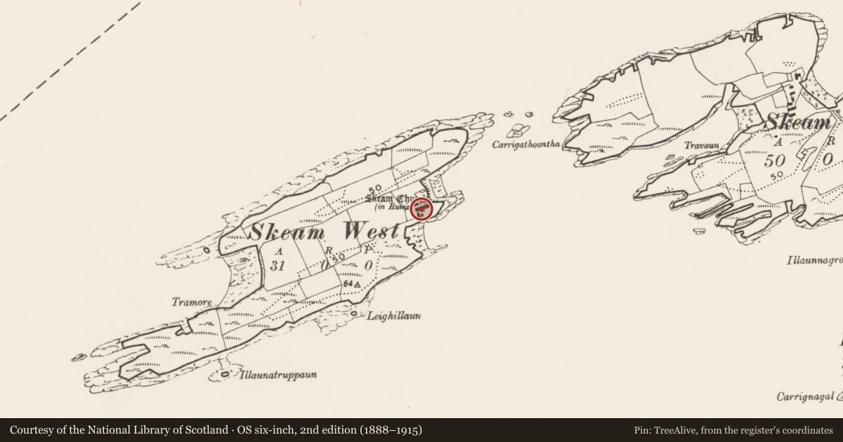
- Skeam Church (in Ruins)
- Coordinates
- 51.50385, -9.45607
- SMR number
- CO149-011002-
Slide toward Today to fade the historical sheet and see the modern map underneath.
David Rumsey Map Collection, Stanford LibrariesDavid Rumsey Map Collection, Stanford LibrariesDavid Rumsey Map Collection, Stanford LibrariesDavid Rumsey Map Collection, Stanford Libraries
4 historical maps cover this location, the earliest the 1841 map "Ireland." (David Rumsey Map Collection, Stanford Libraries).
Historical maps covering this location
- 1841 · Ireland. (David Rumsey Map Collection, Stanford Libraries)
- 1866 · Ireland. (David Rumsey Map Collection, Stanford Libraries)
- 1868 · 4. Ireland. (David Rumsey Map Collection, Stanford Libraries)
- 1882 · Ireland (southern half). (David Rumsey Map Collection, Stanford Libraries)
This record in the National Monuments Service's Historic Environment Viewer ↗
The National Monuments Service's description
On cliff edge, E shore of Skeam West Island. Ruins of rectangular church (3.84m N-S; max. surviving L 6.8m); E end of church fallen into sea. W end preserved to full height; antae project 0.5m beyond side walls, rising to ext. offset on W gable. Blocked rectangular ope in gable above offset. Ext. offset also visible on poorly preserved W wall. Central lintelled door in wall; foundations of splayed ope survive at ground level in S wall. Possible remains of springing course for stone roof at SW corner partially obscured by ivy. Raised rectangular area (10m N-S x 6m E-W) adjoins W end of church; remains of mortares wall at N side. Extensive burial ground (2952) to N and S of church. Excavation (1990) revealed portion of V-shaped ditch (max. Wth 1.5m; D 0.7m) (CO149-011005-) S of church. Remains of secondary habitation to S of church dating to 16th/17th centuries (pers. comm. C. Cotter).
The above description is derived from the published 'Archaeological Inventory of County Cork. Volume 1: West Cork' (Dublin: Stationery Office, 1992). In certain instances the entries have been revised and updated in the light of recent research.
Date of upload/revision: 14 January 2009
Nearby in the register
- Middenunder 1 mi
- Crossunder 1 mi
- Ecclesiastical enclosureunder 1 mi
- Burial groundunder 1 mi
Other entries of the same register within about three miles of this one, by straight line.