Sites and Monuments Record · Ireland
Megalithic tomb - wedge tomb
Leenane, County Cork, Ireland
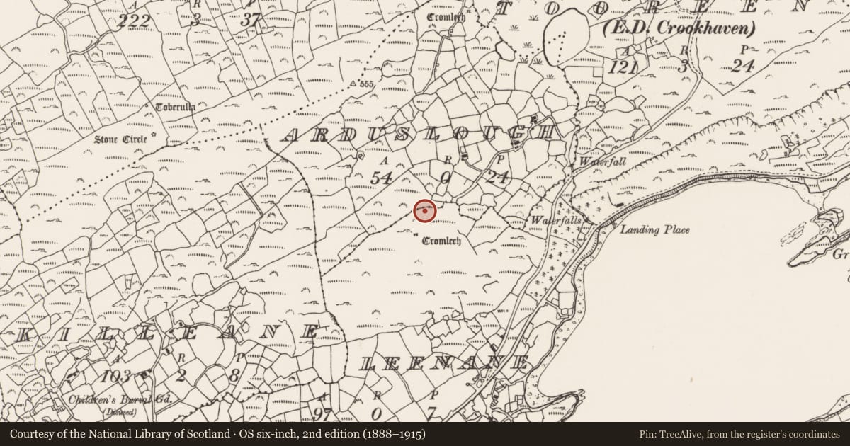
The record
- Townland
- Leenane
- County
- Cork
- Country
- Ireland
- First-edition OS map
- NULL
- Latest-edition OS map
- Not indicated
- Coordinates
- 51.47104, -9.74450
- SMR number
- CO147-069----
Slide toward Today to fade the historical sheet and see the modern map underneath.
David Rumsey Map Collection, Stanford LibrariesDavid Rumsey Map Collection, Stanford LibrariesDavid Rumsey Map Collection, Stanford LibrariesDavid Rumsey Map Collection, Stanford Libraries
4 historical maps cover this location, the earliest the 1841 map "Ireland." (David Rumsey Map Collection, Stanford Libraries).
Historical maps covering this location
- 1841 · Ireland. (David Rumsey Map Collection, Stanford Libraries)
- 1866 · Ireland. (David Rumsey Map Collection, Stanford Libraries)
- 1868 · 4. Ireland. (David Rumsey Map Collection, Stanford Libraries)
- 1882 · Ireland (southern half). (David Rumsey Map Collection, Stanford Libraries)
This record in the National Monuments Service's Historic Environment Viewer ↗
The National Monuments Service's description
On a level shoulder on a SE-facing slope overlooking Crook Haven harbour. The remains can be interpreted as a collapsed chamber, orientated NE-SW, with a roofstone (2.2m x 2m; T 0.25m) resting above a number of slabs which may represent single N and S sidestones with two possible outer-wall stones protruding from under the S side; no evidence of a backstone or mound is visible. While the exact nature of this feature remains uncertain, interpretation as the remains of a megalithic tomb, possibly of the wedge-tomb class, seems likely. A wedge tomb (CO147-045----) with a similar orientation is located 55m to the SW and a standing stone (CO147-074----) is located 180m to the N.
The above description is derived from 'The Archaeological Inventory of County Cork. Volume 5' (Dublin: Stationery Office, 2009).
Date of upload: 22 December 2009
Nearby in the register
- Megalithic tomb - wedge tombunder 1 mi
- Standing stoneunder 1 mi
- Rock scribingunder 1 mi
- Cupmarked stoneunder 1 mi
Other entries of the same register within about three miles of this one, by straight line.