Sites and Monuments Record · Ireland
Country house
Castlefreke, County Cork, Ireland
The record
- Townland
- Castlefreke
- County
- Cork
- Country
- Ireland
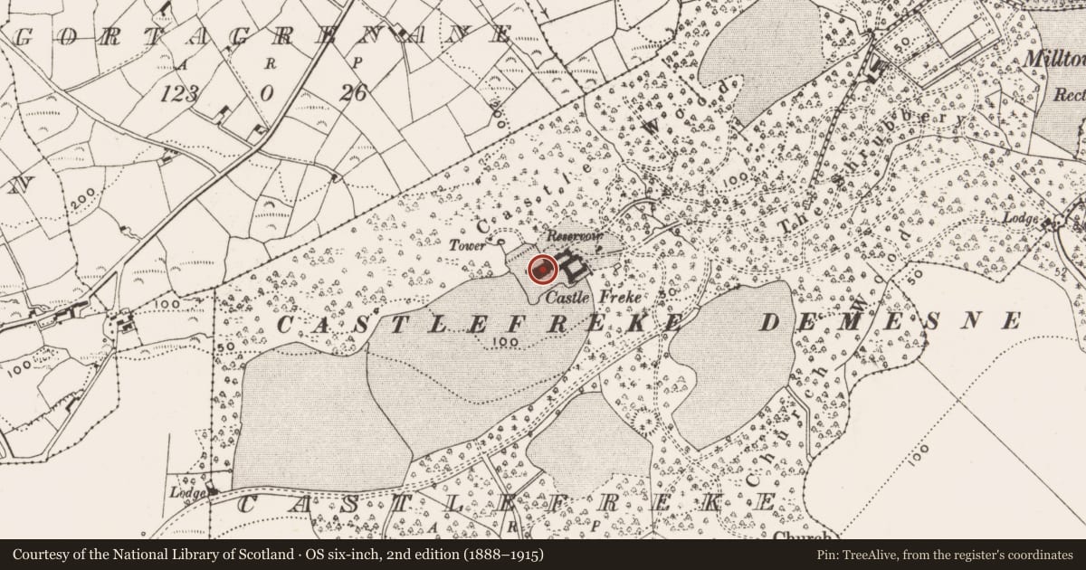
- Latest-edition OS map
- Castle Freke (1944)
- Coordinates
- 51.57064, -8.97845
- SMR number
- CO143-071001-
Slide toward Today to fade the historical sheet and see the modern map underneath.
David Rumsey Map Collection, Stanford LibrariesDavid Rumsey Map Collection, Stanford LibrariesDavid Rumsey Map Collection, Stanford LibrariesDavid Rumsey Map Collection, Stanford Libraries
4 historical maps cover this location, the earliest the 1790 map "Composite: Ireland." (David Rumsey Map Collection, Stanford Libraries).
Historical maps covering this location
- 1790 · Composite: Ireland. (David Rumsey Map Collection, Stanford Libraries)
- 1868 · 4. Ireland. (David Rumsey Map Collection, Stanford Libraries)
- 1882 · Ireland (southern half). (David Rumsey Map Collection, Stanford Libraries)
- 1891 · Ireland 16 (David Rumsey Map Collection, Stanford Libraries)
This record in the National Monuments Service's Historic Environment Viewer ↗
The National Monuments Service's description
Imposing ruin of Castlefreke house overlooking Rosscarbery bay; built in late 18th century by Sir John Evans Freke to replace his earlier residence at Rathbarry Castle (CO143-074002-). Originally a classical structure of 2-storey over basement, 8-bay with 6-bay breakfront. Richard Morisson transformed house in 1820s by adding castellations, bartizans, castellated towers, gateway and portcullis (Bence-Jones 1978, 68). Many estate features survive including walled garden to NE; octagonal tower in woods to NW; farmyard to S incorporating Rathbarry Castle; Church of Ireland to E built adjacent ot Rathbarry church (CO143-076003-). Demesne enclosed by estate wall, with lodges and entrances piers. Imitation high cross on high ground to S; erected in 1901 in memory of the 9th Baron of Carbery who died 1898.
The above description is derived from the published 'Archaeological Inventory of County Cork. Volume 1: West Cork' (Dublin: Stationery Office, 1992). In certain instances the entries have been revised and updated in the light of recent research.
Date of upload/revision: 14 January 2009
Nearby in the register
- Souterrainunder 1 mi
- Enclosureunder 1 mi
- Bullaun stoneunder 1 mi
- Buildingunder 1 mi
Other entries of the same register within about three miles of this one, by straight line.