Sites and Monuments Record · Ireland
Cathedral
Town Lands, County Cork, Ireland
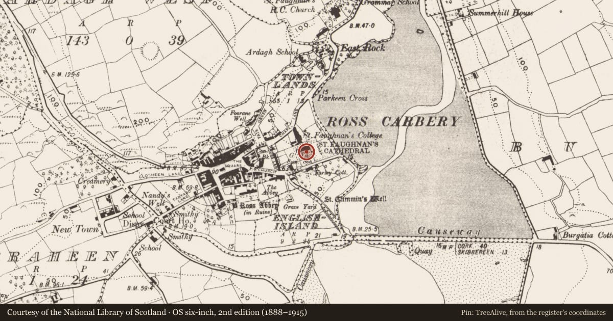
The record
- Townland
- Town Lands
- County
- Cork
- Country
- Ireland
- First-edition OS map
- NULL
- Latest-edition OS map
- St Fachtnas Cathedral (1944)
- Coordinates
- 51.57794, -9.02963
- SMR number
- CO143-023008-
Slide toward Today to fade the historical sheet and see the modern map underneath.
David Rumsey Map Collection, Stanford LibrariesDavid Rumsey Map Collection, Stanford LibrariesDavid Rumsey Map Collection, Stanford LibrariesDavid Rumsey Map Collection, Stanford Libraries
4 historical maps cover this location, the earliest the 1790 map "Composite: Ireland." (David Rumsey Map Collection, Stanford Libraries).
Historical maps covering this location
- 1790 · Composite: Ireland. (David Rumsey Map Collection, Stanford Libraries)
- 1868 · 4. Ireland. (David Rumsey Map Collection, Stanford Libraries)
- 1882 · Ireland (southern half). (David Rumsey Map Collection, Stanford Libraries)
- 1891 · Ireland 16 (David Rumsey Map Collection, Stanford Libraries)
This record in the National Monuments Service's Historic Environment Viewer ↗
The National Monuments Service's description
Overlooking Rosscarbery estuary to S and E; C of I cathedral of Ross. Ancient site of monastery (CO143-023001-) founded by St Fachtna, who died c. 600 (Gwynn and Hadcock 1988, 96). A Protestant cathedral was built here c. 1612 but was burnt in 1642 (Brady 1863, vol. 2, 541); subsequently extensively repaired and restored in 18th and 19th centuries; present C of I cathedral largely 19th century in appearance. Church cruciform in plan with spired tower atop W gable; neo-Romanesque door in W wall; according to Webster (1932, 269) west window (three-light switchline tracery with hood moulding) only surviving part of earlier (i.e. 17th-century) church. Inside, stone screen blocks nave from choir. On floor of nave are two stone fonts (CO143-095---; CO143-096---); over arch at W end is carved head (a flat triangular head with drooping moustache, beard and head-dress); which local tradition says represents St Fachtna (Webster 1932, 269). Graveyard surrounding church still in use; earliest headstones date from late 19th-century; semicircular stone arch just S of church does not appear to be ancient.
See Excavations 2003, 74
The above description is derived from the published 'Archaeological Inventory of County Cork. Volume 1: West Cork' (Dublin: Stationery Office, 1992). In certain instances the entries have been revised and updated in the light of recent research.
Date of upload/revision: 14 January 2009
Nearby in the register
- Fontunder 1 mi
- Fontunder 1 mi
- Graveyardunder 1 mi
- Souterrainunder 1 mi
Other entries of the same register within about three miles of this one, by straight line.