Sites and Monuments Record · Ireland
Promontory fort - coastal
Downmacpatrick Or Old Head, County Cork, Ireland
The record
- Townland
- Downmacpatrick Or Old Head
- County
- Cork
- Country
- Ireland
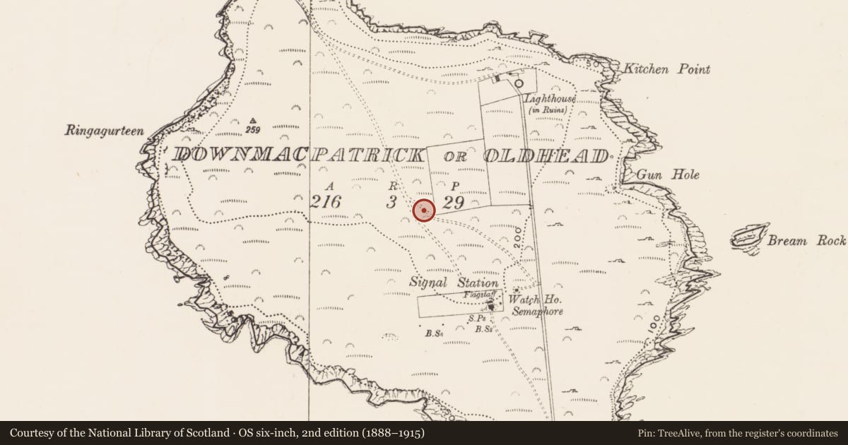
- Latest-edition OS map
- Dunmacpatrick(Duncarmna) (Site of) (1902)
- Coordinates
- 51.61047, -8.53679
- SMR number
- CO137A001001-
Slide toward Today to fade the historical sheet and see the modern map underneath.
David Rumsey Map Collection, Stanford LibrariesDavid Rumsey Map Collection, Stanford LibrariesDavid Rumsey Map Collection, Stanford LibrariesDavid Rumsey Map Collection, Stanford Libraries
4 historical maps cover this location, the earliest the 1790 map "Composite: Ireland." (David Rumsey Map Collection, Stanford Libraries).
Historical maps covering this location
- 1790 · Composite: Ireland. (David Rumsey Map Collection, Stanford Libraries)
- 1868 · 4. Ireland. (David Rumsey Map Collection, Stanford Libraries)
- 1882 · Ireland (southern half). (David Rumsey Map Collection, Stanford Libraries)
- 1891 · Ireland 16 (David Rumsey Map Collection, Stanford Libraries)
This record in the National Monuments Service's Historic Environment Viewer ↗
The National Monuments Service's description
Though obviously late-medieval in date the stone-built fortifications (CO137-009001-), across the narrow neck of the Old Head of Kinsale, are built in line with a substantial rock-cut fosse (D 2.5m-6m; Wth 6m) which could be of an earlier date and 'may very probably be a remnant of the earlier promontory fort' (Westropp 1914, 122). The early historical references to Dún Cermna on the Old Head are documented by O'Rahilly (1939,16-20) who identifies it as an important Pre-Christian settlement. Though no apparent traces of prehistoric habitation are evident on the headland itself, much features as hut-sites were evident before reclaimed and ploughed in the 1970s (pers. comm. Eugene Gillen).
The above description is derived from the published 'Archaeological Inventory of County Cork. Volume 2: East and South Cork' (Dublin: Stationery Office, 1994). In certain instances the entries have been revised and updated in the light of recent research.
Date of upload/revision: 14 January 2009
This monument is subject to a preservation order made under the National Monuments Acts 1930 to 2014 (PO no. 9/1978).
Nearby in the register
- Megalithic structureunder 1 mi
- Lighthouseunder 1 mi
- Lighthouseunder 1 mi
- Hut siteunder 1 mi
Other entries of the same register within about three miles of this one, by straight line.