Sites and Monuments Record · Ireland
Castle - tower house
Rossmore (Carbery West (W.D) By.), County Cork, Ireland
The record
- Townland
- Rossmore (Carbery West (W.D) By.)
- County
- Cork
- Country
- Ireland
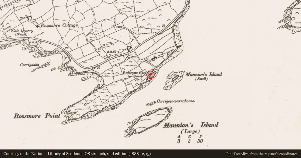
- Latest-edition OS map
- Rossmore Castle (in Ruins) (1901)
- Coordinates
- 51.61126, -9.55580
- SMR number
- CO130-009----
Slide toward Today to fade the historical sheet and see the modern map underneath.
David Rumsey Map Collection, Stanford LibrariesDavid Rumsey Map Collection, Stanford LibrariesDavid Rumsey Map Collection, Stanford LibrariesDavid Rumsey Map Collection, Stanford Libraries
4 historical maps cover this location, the earliest the 1790 map "Composite: Ireland." (David Rumsey Map Collection, Stanford Libraries).
Historical maps covering this location
- 1790 · Composite: Ireland. (David Rumsey Map Collection, Stanford Libraries)
- 1868 · 4. Ireland. (David Rumsey Map Collection, Stanford Libraries)
- 1882 · Ireland (southern half). (David Rumsey Map Collection, Stanford Libraries)
- 1891 · Ireland 16 (David Rumsey Map Collection, Stanford Libraries)
This record in the National Monuments Service's Historic Environment Viewer ↗
The National Monuments Service's description
Fragmentary, ivy-clad remains of tower on N shore of Dunmanus Bay. N wall stands to three storeys (Wth 14.5m E-W) with short returns of E (L 3.8m) and W (L 7m) walls. Ground floor doorway near N end of W wall with pointed arch, now blocked by wall of farm building. W end of N wall curved internally to form part of stairwell; at first floor level W jamb of door from stairs survives. Central window in N wall has splayed lintelled linteled embrasure. Part of second floor survives to E of centre where a segmental vaulted window embrasure can be made out. Splaying downwards from second floor level on external wall face are gable-shaped gun loops. Exit chute for garderobe near E end of external N face. Probably an O'Mahony castle, later passed to MacCarthy Muclaghs (O'Donoghue 1986, 58).
The above description is derived from the published 'Archaeological Inventory of County Cork. Volume 1: West Cork' (Dublin: Stationery Office, 1992). In certain instances the entries have been revised and updated in the light of recent research.
Date of upload/revision: 14 January 2009
Nearby in the register
- Souterrainunder 1 mi
- Promontory fort - coastalunder 1 mi
- Souterrainunder 1 mi
- House - fortified houseunder 1 mi
Other entries of the same register within about three miles of this one, by straight line.