Sites and Monuments Record · Ireland
Country house
Dunboy, County Cork, Ireland
The record
- Townland
- Dunboy
- County
- Cork
- Country
- Ireland
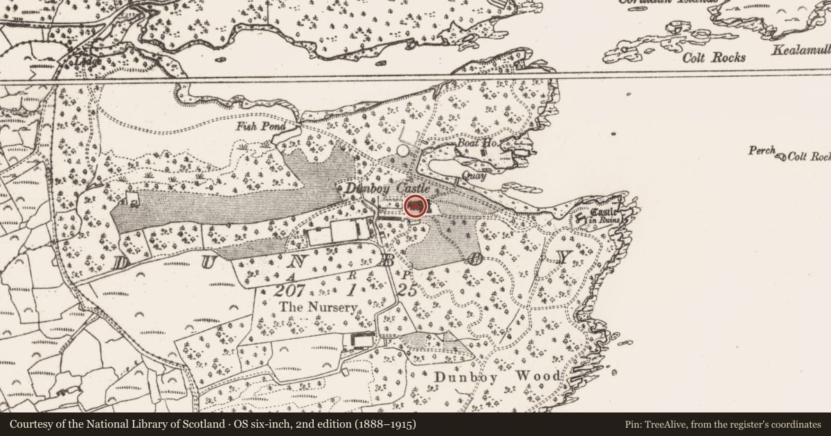
- Latest-edition OS map
- Dunboy Castle (1901)
- Coordinates
- 51.63342, -9.92966
- SMR number
- CO128-019----
Slide toward Today to fade the historical sheet and see the modern map underneath.
David Rumsey Map Collection, Stanford LibrariesDavid Rumsey Map Collection, Stanford LibrariesDavid Rumsey Map Collection, Stanford LibrariesDavid Rumsey Map Collection, Stanford Libraries
4 historical maps cover this location, the earliest the 1790 map "Composite: Ireland." (David Rumsey Map Collection, Stanford Libraries).
Historical maps covering this location
- 1790 · Composite: Ireland. (David Rumsey Map Collection, Stanford Libraries)
- 1868 · 4. Ireland. (David Rumsey Map Collection, Stanford Libraries)
- 1869 · Ireland. (David Rumsey Map Collection, Stanford Libraries)
- 1891 · Ireland 16 (David Rumsey Map Collection, Stanford Libraries)
This record in the National Monuments Service's Historic Environment Viewer ↗
The National Monuments Service's description
Originally built in 1739 for Henry and John Puxley, this country house was extensively rebuilt and remodeled in the 1860s for Henry Lavallin-Puxley by architect John Christopher. Burned in 1921 it remained a ruin until the mid-2000s when work commenced on its conversion to a hotel (Irish Examiner, 7 May 2011). The house is irregular in plan with castellated towers and gabled projections. Imposing Victorian 2-storey over basement addition to E, built by Puxley in 1880 (Bence Jones 1978, 114) with steeply pitched gables, single stacks, bay and oriel windows; unusual series of pointed arches over main hall. (Bence Jones 1978, 114; Power et al. 1992, no. 3406; http://www.buildingsofireland.ie/niah/search.jsp?type=record&county=CO®no=20912801, accessed 6 Oct. 2017)
Revised by: Paul Walsh
Date of upload: 6 October 2017
References
Power, D., Byrne, E., Egan, U., Lane, S. and Sleeman, M. 1992 (Reprint 2003) Archaeological inventory of county Cork, vol. 1: West Cork. Dublin. Stationery Office.
Bence-Jones, M. 1978 Burke's Guide to Country Houses: Volume 1 Ireland. London. Burke's Peerage Ltd.
Nearby in the register
- Middenunder 1 mi
- Sea wallunder 1 mi
- Hut siteunder 1 mi
- Military campunder 1 mi
Other entries of the same register within about three miles of this one, by straight line.