Sites and Monuments Record · Ireland
Cross
Kilnaruane, County Cork, Ireland
The record
- Townland
- Kilnaruane
- County
- Cork
- Country
- Ireland
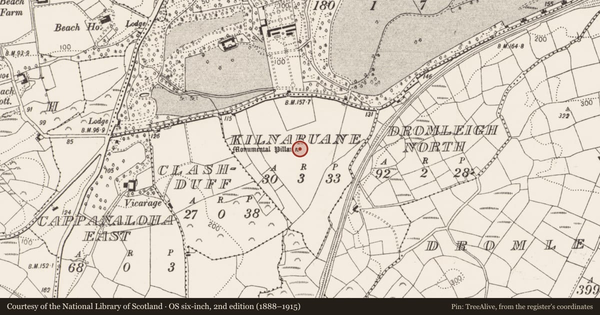
- Latest-edition OS map
- Monumental Pillar (1944)
- Coordinates
- 51.67131, -9.46803
- SMR number
- CO118-031003-
Slide toward Today to fade the historical sheet and see the modern map underneath.
David Rumsey Map Collection, Stanford LibrariesDavid Rumsey Map Collection, Stanford LibrariesDavid Rumsey Map Collection, Stanford LibrariesDavid Rumsey Map Collection, Stanford Libraries
4 historical maps cover this location, the earliest the 1790 map "Composite: Ireland." (David Rumsey Map Collection, Stanford Libraries).
Historical maps covering this location
- 1790 · Composite: Ireland. (David Rumsey Map Collection, Stanford Libraries)
- 1869 · Ireland. (David Rumsey Map Collection, Stanford Libraries)
- 1882 · Ireland (southern half). (David Rumsey Map Collection, Stanford Libraries)
- 1891 · Ireland 16 (David Rumsey Map Collection, Stanford Libraries)
This record in the National Monuments Service's Historic Environment Viewer ↗
The National Monuments Service's description
Upright stone (H 2.05m; 0.26m x 0.15m), long axis NE-SW, in burial ground (CO118-031002-) in early ecclesiastical enclosure (CO118-031001-). SW face divided into four panels: uppermost, two pieces of ribbon interlace; second panel, praying figure; third, Greek cross; lowest, St Paul and St Anthony seated at pedestal table holding bread. NE face divided into three panels: topmost, remains of spiral interlace; second, two pairs four legged animals; third, boat with four oarsmen and fifth figure steering in stern, rowing through sea of crosses. Two incisions (L 0.06; Wth 0.03; D 0.04) on top pillar indicate attachment of an original further element. Adjacent are four deeply grooved boulders which may have functioned as hinge/cornerstones in structure. (Hourihane and Hourihane 1979, 65-73).
The above description is derived from the published 'Archaeological Inventory of County Cork. Volume 1: West Cork' (Dublin: Stationery Office, 1992). In certain instances the entries have been revised and updated in the light of recent research.
Date of upload/revision: 14 January 2009
Nearby in the register
- Bullaun stoneunder 1 mi
- Architectural fragmentunder 1 mi
- Ecclesiastical enclosureunder 1 mi
- Burial groundunder 1 mi
Other entries of the same register within about three miles of this one, by straight line.