Sites and Monuments Record · Ireland
Bastioned fort
Newtown (Bantry By.), County Cork, Ireland
The record
- Townland
- Newtown (Bantry By.)
- County
- Cork
- Country
- Ireland
- First-edition OS map
- NULL
- Latest-edition OS map
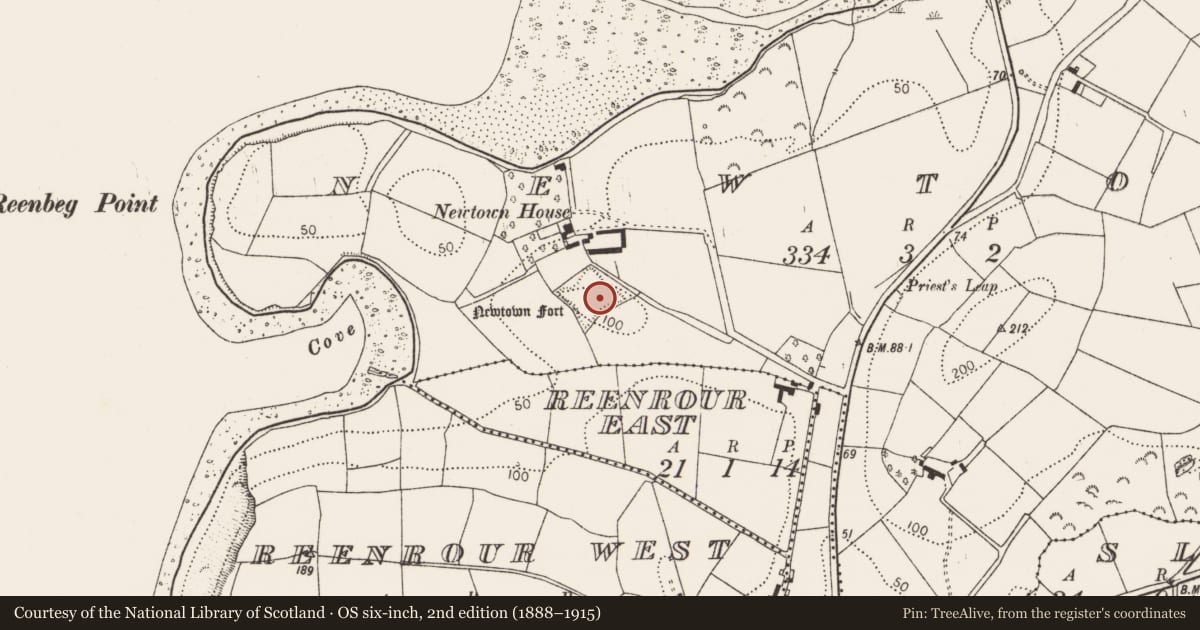
- Newtown Fort (1944)
- Coordinates
- 51.68768, -9.45149
- SMR number
- CO118-002001-
Slide toward Today to fade the historical sheet and see the modern map underneath.
David Rumsey Map Collection, Stanford LibrariesDavid Rumsey Map Collection, Stanford LibrariesDavid Rumsey Map Collection, Stanford LibrariesDavid Rumsey Map Collection, Stanford Libraries
4 historical maps cover this location, the earliest the 1790 map "Composite: Ireland." (David Rumsey Map Collection, Stanford Libraries).
Historical maps covering this location
- 1790 · Composite: Ireland. (David Rumsey Map Collection, Stanford Libraries)
- 1869 · Ireland. (David Rumsey Map Collection, Stanford Libraries)
- 1882 · Ireland (southern half). (David Rumsey Map Collection, Stanford Libraries)
- 1891 · Ireland 16 (David Rumsey Map Collection, Stanford Libraries)
This record in the National Monuments Service's Historic Environment Viewer ↗
The National Monuments Service's description
On top of a knoll on a slight promontory at E end of Bantry bay. Now heavily overgrown and difficult to make out. The ditch is preserved (Wth 4-4.5m; D 1.5-2m) and shows the outline of a roughly square fort (70m square) with pointed bastions at each corner; entrance to S; well in interior. Built in 1650s by Orrery; re-fortified in 1672 but demolished in 1689 (Gowan 1979, 251-3). Contemporary with the fort was a village known as Newtown which had a population of 119 in 1659 (Hourihan 1977, 86) but disappeared shortly afterwards. It was situated immediately NE of the fort (local tradition): no visible remains.
See Breen, C. 2002 'Newtown; 17-century fort and village' in I. Bennett (ed.), Excavations 2000: summary accounts of archaeological excavations in Ireland, 50-51. Wordwell Ltd, Bray.
The above description is derived from the published 'Archaeological Inventory of County Cork. Volume 1: West Cork' (Dublin: Stationery Office, 1992). In certain instances the entries have been revised and updated in the light of recent research.
Date of upload/revision: 14 January 2009
Nearby in the register
- Country houseunder 1 mi
- Enclosureunder 1 mi
- Souterrainunder 1 mi
- Enclosureunder 1 mi
Other entries of the same register within about three miles of this one, by straight line.