Sites and Monuments Record · Ireland
Castle - tower house
Kilgobbin, County Cork, Ireland
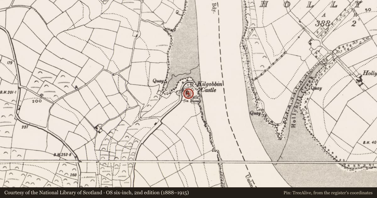
The record
- Townland
- Kilgobbin
- County
- Cork
- Country
- Ireland
- Latest-edition OS map
- Castle (in Ruins) (1939)
- Coordinates
- 51.70114, -8.60307
- SMR number
- CO111-064----
Slide toward Today to fade the historical sheet and see the modern map underneath.
David Rumsey Map Collection, Stanford LibrariesDavid Rumsey Map Collection, Stanford LibrariesDavid Rumsey Map Collection, Stanford LibrariesDavid Rumsey Map Collection, Stanford Libraries
4 historical maps cover this location, the earliest the 1790 map "Composite: Ireland." (David Rumsey Map Collection, Stanford Libraries).
Historical maps covering this location
- 1790 · Composite: Ireland. (David Rumsey Map Collection, Stanford Libraries)
- 1869 · Ireland. (David Rumsey Map Collection, Stanford Libraries)
- 1882 · Ireland (southern half). (David Rumsey Map Collection, Stanford Libraries)
- 1891 · Ireland 16 (David Rumsey Map Collection, Stanford Libraries)
This record in the National Monuments Service's Historic Environment Viewer ↗
The National Monuments Service's description
On W bank of Bandon river just S of narrow inlet, ground rises to SW. Rectangular, 5 storey tower (9.65m E-W; 8.9m N-S) standing to full height. Abandoned, 2 storey 19th century house abuts N wall; lean-to farmbuildings stand against S and W walls. Ground floor entrance at W end of N wall now blocked up; entery now gained through large broken ope in E wall. First floor attic under rounded, wicker-centered vault (axis E-W); manhole through vault near SW corner. Access to floors over vault not gained but there appears to be a second vault over 3rd floor (Healy 1988, 269). Single square-headed lights on all faces at 3rd floor level. At 4th floor level frame of triple, ogee headed light on E face; tall single ogee headed lights on other faces. Stairs to wall walk at NE corner. A castle of the Mac Carthy Riabhach clan (O Murchadha 1985, 54).
The above description is derived from the published 'Archaeological Inventory of County Cork. Volume 1: West Cork' (Dublin: Stationery Office, 1992). In certain instances the entries have been revised and updated in the light of recent research.
Date of upload/revision: 14 January 2009
Nearby in the register
- Country houseunder 1 mi
- Souterrainunder 1 mi
- Ringfort - rathunder 1 mi
- Ringfort - rath1 mi
Other entries of the same register within about three miles of this one, by straight line.