Sites and Monuments Record · Ireland
Church
Coolfadda, County Cork, Ireland
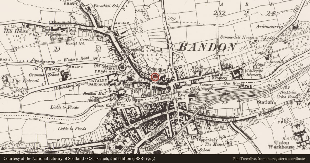
The record
- Townland
- Coolfadda
- County
- Cork
- Country
- Ireland
- Latest-edition OS map
- Ch (1939)
- Coordinates
- 51.74717, -8.73667
- SMR number
- CO110-019008-
Slide toward Today to fade the historical sheet and see the modern map underneath.
David Rumsey Map Collection, Stanford LibrariesDavid Rumsey Map Collection, Stanford LibrariesDavid Rumsey Map Collection, Stanford LibrariesDavid Rumsey Map Collection, Stanford Libraries
4 historical maps cover this location, the earliest the 1790 map "Composite: Ireland." (David Rumsey Map Collection, Stanford Libraries).
Historical maps covering this location
- 1790 · Composite: Ireland. (David Rumsey Map Collection, Stanford Libraries)
- 1865 · Ireland, (South) Sheet. (David Rumsey Map Collection, Stanford Libraries)
- 1882 · Ireland (southern half). (David Rumsey Map Collection, Stanford Libraries)
- 1891 · Ireland 16 (David Rumsey Map Collection, Stanford Libraries)
This record in the National Monuments Service's Historic Environment Viewer ↗
The National Monuments Service's description
In graveyard, atop ridge on N side of Bandon. Built 1610 (O Riordáin) 1933,18); concecrated 1625 (O'Flanagan 1988, 10); enlarged 1829 (Brady 1863, vol. 1, 144). Traces of 'old entrenchment' [CO110-0190015-] found when church was repaired c. 1843 (O Ríordáin 1933, 18). Cruciform church, long axis E-W; chance ladded to E. Tower with spire at SW corner of nave; porch added to S wall of nave; lean-to additions to transepts. Triple light windows in nave and transepts. Weathered stone plaque on external S wall of nave with inscription '1625 Memento Mori' (O Ríordáin 1933, 18). Interior now gutted except for 18th and 19th century wall memorials. Graveyard enclosed by stone wall; N section on line of town wall (3321); iron railing on wall to S with central ashler entrance piers. Headstones date from early 18th century to present day.
The above description is derived from the published 'Archaeological Inventory of County Cork. Volume 1: West Cork' (Dublin: Stationery Office, 1992). In certain instances the entries have been revised and updated in the light of recent research.
Date of upload/revision: 14 January 2009
Nearby in the register
- Graveyardunder 1 mi
- Earthworkunder 1 mi
- House - 17th centuryunder 1 mi
- Prisonunder 1 mi
Other entries of the same register within about three miles of this one, by straight line.