Sites and Monuments Record · Ireland
Ringfort - rath
Laharanshermeen, County Cork, Ireland
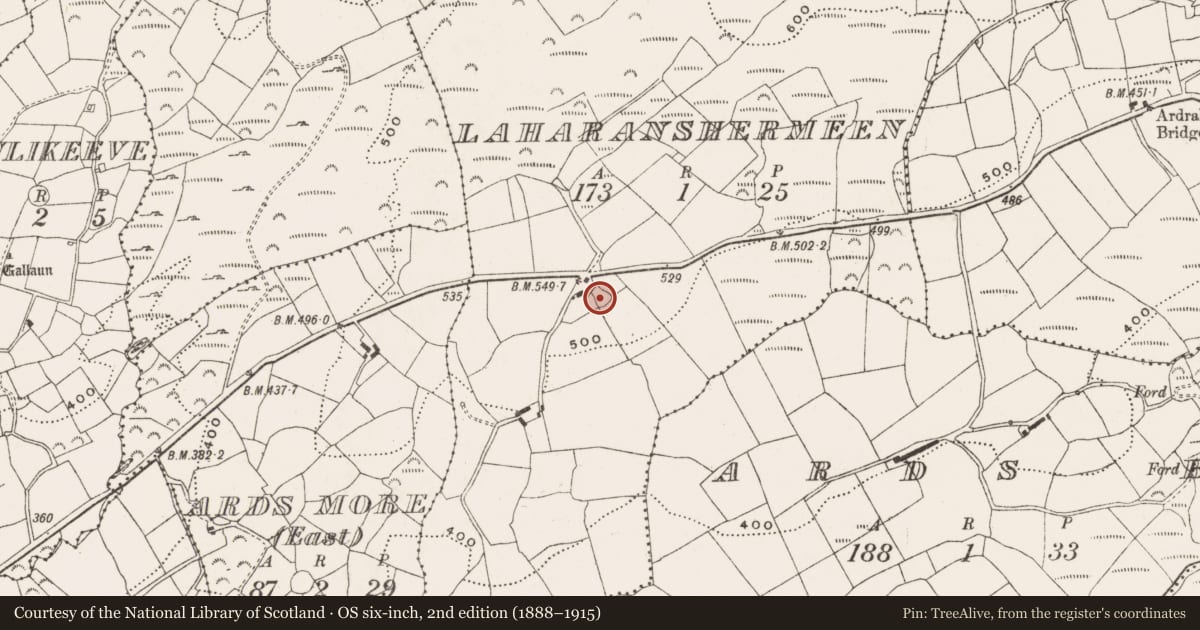
The record
- Townland
- Laharanshermeen
- County
- Cork
- Country
- Ireland
- Latest-edition OS map
- Not indicated
- Coordinates
- 51.72869, -9.35605
- SMR number
- CO106-081----
Slide toward Today to fade the historical sheet and see the modern map underneath.
David Rumsey Map Collection, Stanford LibrariesDavid Rumsey Map Collection, Stanford LibrariesDavid Rumsey Map Collection, Stanford LibrariesDavid Rumsey Map Collection, Stanford Libraries
4 historical maps cover this location, the earliest the 1790 map "Composite: Ireland." (David Rumsey Map Collection, Stanford Libraries).
Historical maps covering this location
- 1790 · Composite: Ireland. (David Rumsey Map Collection, Stanford Libraries)
- 1865 · Ireland, (South) Sheet. (David Rumsey Map Collection, Stanford Libraries)
- 1882 · Ireland (southern half). (David Rumsey Map Collection, Stanford Libraries)
- 1891 · Ireland 16 (David Rumsey Map Collection, Stanford Libraries)
This record in the National Monuments Service's Historic Environment Viewer ↗
The National Monuments Service's description
In pasture, on a terrace on a S-facing slope with commanding views across the valley of the Mealagh River to Mullaghmesha. A roughly circular area (diam. c. 24m) is defined by a scarp (H 0.1m NW and NE) which heightens towards the S (H 1.25m). The enclosing element is damaged and unclear NW-NE. The original scarp survives best along the S arc where it has been faced with a stone wall, which is obscured by briars and grass. The W and E arcs have been cut through and are now faced with linear stone walls, also obscured by overgrowth. Traces of the original earthen scarp were noted near the N and S ends of these walls. A more recent enclosing element of earth and stone (Wth 0.6-2m; H 0.2-0.8m), overgrown and with several breaks, has been added on top of the stone walls and along the present perimeter, except at NW-NE. An external depression beside the W wall appears to be a recent feature. The interior, with a small depression in the centre, is slightly uneven and displays traces of cultivation. Trees grow around the N half of the rath. This rath was identified by Myler (1998, 50).
The above description is derived from 'The Archaeological Inventory of County Cork. Volume 5' (Dublin: Stationery Office, 2009).
Date of upload: 22 December 2009
Nearby in the register
- Enclosureunder 1 mi
- Standing stoneunder 1 mi
- Ringfort - rathunder 1 mi
- Enclosureunder 1 mi
Other entries of the same register within about three miles of this one, by straight line.