Sites and Monuments Record · Ireland
Castle - tower house
Carriganass (Bantry By.), County Cork, Ireland
The record
- Townland
- Carriganass (Bantry By.)
- County
- Cork
- Country
- Ireland
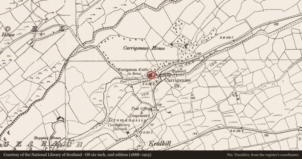
- Latest-edition OS map
- Carriganass Castle (in Ruins) (1902)
- Coordinates
- 51.75399, -9.37943
- SMR number
- CO106-001----
Slide toward Today to fade the historical sheet and see the modern map underneath.
David Rumsey Map Collection, Stanford LibrariesDavid Rumsey Map Collection, Stanford LibrariesDavid Rumsey Map Collection, Stanford LibrariesDavid Rumsey Map Collection, Stanford Libraries
4 historical maps cover this location, the earliest the 1790 map "Composite: Ireland." (David Rumsey Map Collection, Stanford Libraries).
Historical maps covering this location
- 1790 · Composite: Ireland. (David Rumsey Map Collection, Stanford Libraries)
- 1865 · Ireland, (South) Sheet. (David Rumsey Map Collection, Stanford Libraries)
- 1882 · Ireland (southern half). (David Rumsey Map Collection, Stanford Libraries)
- 1891 · Ireland 16 (David Rumsey Map Collection, Stanford Libraries)
This record in the National Monuments Service's Historic Environment Viewer ↗
The National Monuments Service's description
On N bank of Owvane river commanding view in all directions; overlooked from N. Remains of tower-house stand in SW quadrant of rectangular bawn. W wall of tower (Wth 10.3m), most of N wall (L 12m) and short return of S wall (L 2m) stand to four storey. 'Ghost' of segmental vaults over 1st and 3rd floors visible on inside of W face (axis E-W). Central window opes in W wall at all levels; first floor embrasure has mural passage on either side; single ogee-headed light at 3rd floor. Small mural chamber in N wall at 1st floor level; mural passage visible in broken face of S wall at 3rd floor level. Similar bartizans atop NW and SW corners: supported by a corbel on each wall with a straight face set across corner.
Bawn roughly rectangular in plan (26m N-S; 48m E-W) projecting towers at each corner; S face overlooks rock-cut gorge. Appears late in date, probably 17th century. Eastern half altered to accommodate modern farm buildings (now disused). W wall and original W end of N wall pierced by many gun loops. Outward facing corners NE and SE corner towers acutely angled, similar to bastions on star-shaped forts; NW tower more bluntly pointed; SW tower roughly rectangular. SW tower has 4 tiers of nesting boxes on each face at 1st floor level. Castle of the O'Sullivan clan reputedly built by Dermot O'Sullivan about 1540 (Healy 1988, 170); surrendered after the fall of Dunboy in 1602 (Ó Murchadha 1985, 308).
See Excavations 2002, 63, nos. 247-249 and Excavations 2004, 46-7, no. 212.
The above description is derived from the published 'Archaeological Inventory of County Cork. Volume 1: West Cork' (Dublin: Stationery Office, 1992). In certain instances the entries have been revised and updated in the light of recent research.
Date of upload/revision: 14 January 2009
Nearby in the register
- Bawnunder 1 mi
- Fulacht fiaunder 1 mi
- Enclosureunder 1 mi
- Stone circle - five-stoneunder 1 mi
Other entries of the same register within about three miles of this one, by straight line.