Sites and Monuments Record · Ireland
Country house
Kilnaglery, County Cork, Ireland
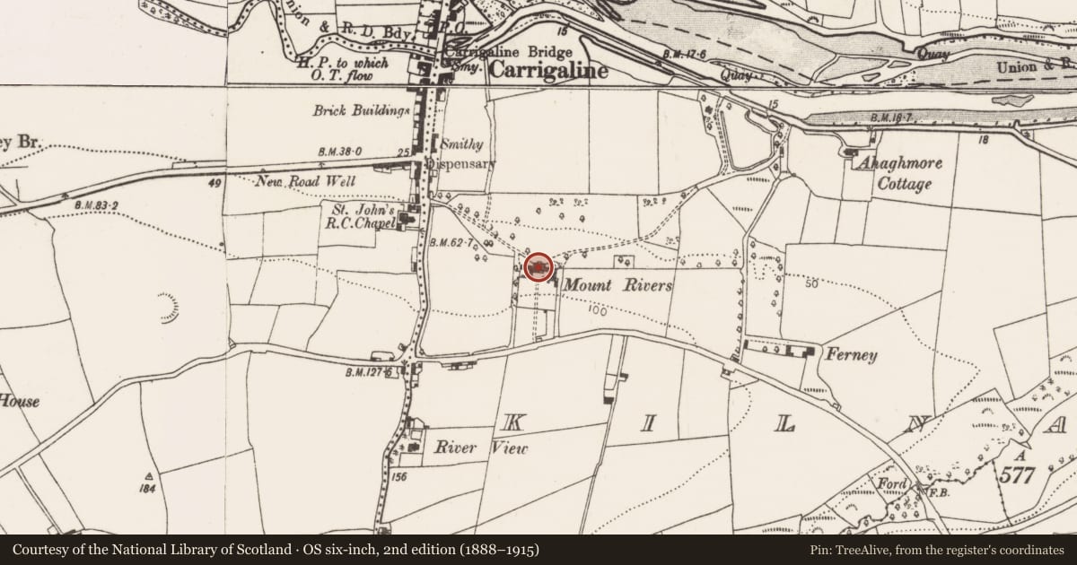
The record
- Townland
- Kilnaglery
- County
- Cork
- Country
- Ireland
- First-edition OS map
- NULL
- Latest-edition OS map
- Mount Rivers (1934)
- Coordinates
- 51.81002, -8.39005
- SMR number
- CO099-095----
Slide toward Today to fade the historical sheet and see the modern map underneath.
David Rumsey Map Collection, Stanford LibrariesDavid Rumsey Map Collection, Stanford LibrariesDavid Rumsey Map Collection, Stanford LibrariesDavid Rumsey Map Collection, Stanford Libraries
4 historical maps cover this location, the earliest the 1790 map "Composite: Ireland." (David Rumsey Map Collection, Stanford Libraries).
Historical maps covering this location
- 1790 · Composite: Ireland. (David Rumsey Map Collection, Stanford Libraries)
- 1882 · Ireland (southern half). (David Rumsey Map Collection, Stanford Libraries)
- 1883 · Ireland 3. (David Rumsey Map Collection, Stanford Libraries)
- 1891 · Ireland 16 (David Rumsey Map Collection, Stanford Libraries)
This record in the National Monuments Service's Historic Environment Viewer ↗
The National Monuments Service's description
On SE side of Carrigaline. According to owner built in 1760s by James Morrison, Entrance front (N) of 4-bays, 3-storeys; central ground floor door set in recess with convex sides containing large window; recess framed by wooden portico with slim doric columns. Rounded corner of front elevation, framed by blocked quoins; windows in curve at same level as front windows but one light wider. Hipped roof with projecting eaves. Eelevation weatherslated. Bence Jones (1978, 216) suggest the house originally 'had a front consisting of a centre recessed between two projections with rounded corners. At a later date, the centre in the two upper storeys was filled in'. According to the owner the recess was filled in 1830s when 2nd floor was added. Remains of square 2-storey gate tower in walled garden to S with remains of bellcote on top.
The above description is derived from the published 'Archaeological Inventory of County Cork. Volume 2: East and South Cork' (Dublin: Stationery Office, 1994). In certain instances the entries have been revised and updated in the light of recent research.
Date of upload/revision: 14 January 2009
Nearby in the register
- Excavation - miscellaneousunder 1 mi
- Mill - unclassifiedunder 1 mi
- Ringfort - rathunder 1 mi
- Fulacht fiaunder 1 mi
Other entries of the same register within about three miles of this one, by straight line.