Sites and Monuments Record · Ireland
Country house
Coolmore (Kerrycurrihy By.), County Cork, Ireland
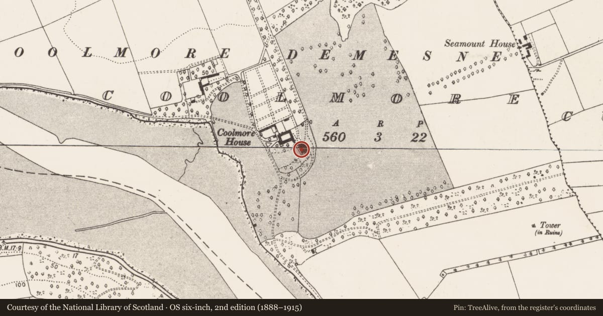
The record
- Townland
- Coolmore (Kerrycurrihy By.)
- County
- Cork
- Country
- Ireland
- Latest-edition OS map
- Coolmore House (1934)
- Coordinates
- 51.81244, -8.34186
- SMR number
- CO099-006----
Slide toward Today to fade the historical sheet and see the modern map underneath.
David Rumsey Map Collection, Stanford LibrariesDavid Rumsey Map Collection, Stanford LibrariesDavid Rumsey Map Collection, Stanford LibrariesDavid Rumsey Map Collection, Stanford Libraries
4 historical maps cover this location, the earliest the 1790 map "Composite: Ireland." (David Rumsey Map Collection, Stanford Libraries).
Historical maps covering this location
- 1790 · Composite: Ireland. (David Rumsey Map Collection, Stanford Libraries)
- 1882 · Ireland (southern half). (David Rumsey Map Collection, Stanford Libraries)
- 1883 · Ireland 3. (David Rumsey Map Collection, Stanford Libraries)
- 1891 · Ireland 16 (David Rumsey Map Collection, Stanford Libraries)
This record in the National Monuments Service's Historic Environment Viewer ↗
The National Monuments Service's description
Late 18th century, 3-storey house over basement. Entrance front (E) of 6 bays with 2-bay breakfront framed by rusticated pilasters. Central vertical half door, framed by engaged doric stone columns supporting a broken pediment; armorial plaque in tympanum. Door ope flanked by large sash windows; steps over basement up to door. Five bay deep on the return. Hipped roof with central valley, parapet wall. Bence Jones (1987, 91) noted late 18th-century plasterwork and 19th century wallpaper in interior. Stables to N connected to house by corridor at basement level. Stewards house and farm buildings (CO087-042001-) to NW, yard contains five identical corn stands.These are circular stone built structures with arched opes facing N, E, S, W which lead into a domed chamber with central brick pier; exterior walling formerly weatherslated. Ice-house (CO087-042002-) to S of farmyard. Entrance gates flanked by eight lodges built in 1815 in the 'Cottage Gothic' style.
The above description is derived from the published 'Archaeological Inventory of County Cork. Volume 2: East and South Cork' (Dublin: Stationery Office, 1994). In certain instances the entries have been revised and updated in the light of recent research.
Date of upload/revision: 14 January 2009
Nearby in the register
- Icehouseunder 1 mi
- Buildingunder 1 mi
- Enclosureunder 1 mi
- Designed landscape - belvedereunder 1 mi
Other entries of the same register within about three miles of this one, by straight line.