Sites and Monuments Record · Ireland
Church
Mill-Land, County Cork, Ireland
The record
- Townland
- Mill-Land
- County
- Cork
- Country
- Ireland
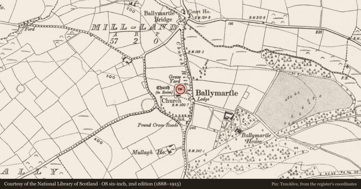
- Latest-edition OS map
- Church (in Ruins) (1934)
- Coordinates
- 51.77171, -8.51936
- SMR number
- CO098-027002-
Slide toward Today to fade the historical sheet and see the modern map underneath.
David Rumsey Map Collection, Stanford LibrariesDavid Rumsey Map Collection, Stanford LibrariesDavid Rumsey Map Collection, Stanford LibrariesDavid Rumsey Map Collection, Stanford Libraries
4 historical maps cover this location, the earliest the 1790 map "Composite: Ireland." (David Rumsey Map Collection, Stanford Libraries).
Historical maps covering this location
- 1790 · Composite: Ireland. (David Rumsey Map Collection, Stanford Libraries)
- 1865 · Ireland, (South) Sheet. (David Rumsey Map Collection, Stanford Libraries)
- 1882 · Ireland (southern half). (David Rumsey Map Collection, Stanford Libraries)
- 1891 · Ireland 16 (David Rumsey Map Collection, Stanford Libraries)
This record in the National Monuments Service's Historic Environment Viewer ↗
The National Monuments Service's description
In centre of graveyard (CO098-027001-), remains of gable-ended rectangular church (int.: 16.7m, E-W; 6.6m N-S). Interior overgrown and used as dump for graveyard rubbish. Central window ope in E wall, much ruined; S wall collapsed, gap near E end indicates former window position. Tall central window ope in W wall, splayed embrasure, upper part collapsed. Large flat-topped burial vault occupies most of western third of interior. Church described as 'in good repair' in 1699, functioned as C of I parish church of Ballymartle until new church (CO098-027003-) built to S c. 1840. In 1837 described as'so old and decayed that no record exists of the date and cost of its erection' (Brady 1863, vol. 1, 31-3). Ball-Wright (1907-9) records memorial dated 1702 'in the new church' and one dated 1717 'in the chancel of the old church', both to Meade family of Ballintober CO112-055---).
The above description is derived from the published 'Archaeological Inventory of County Cork. Volume 2: East and South Cork' (Dublin: Stationery Office, 1994). In certain instances the entries have been revised and updated in the light of recent research.
Date of upload/revision: 14 January 2009
Nearby in the register
- Graveyardunder 1 mi
- Churchunder 1 mi
- Ringfort - rathunder 1 mi
- Country houseunder 1 mi
Other entries of the same register within about three miles of this one, by straight line.