Sites and Monuments Record · Ireland
Church
Aghada, County Cork, Ireland
The record
- Townland
- Aghada
- County
- Cork
- Country
- Ireland
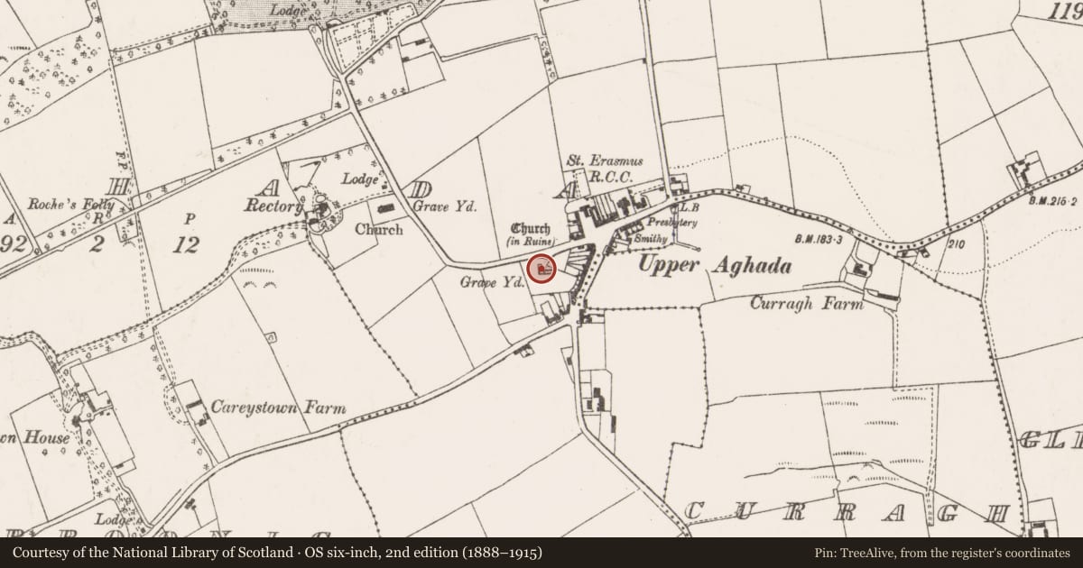
- Latest-edition OS map
- Church (in Ruins) (1935)
- Coordinates
- 51.83626, -8.21101
- SMR number
- CO088-035002-
Slide toward Today to fade the historical sheet and see the modern map underneath.
David Rumsey Map Collection, Stanford LibrariesDavid Rumsey Map Collection, Stanford LibrariesDavid Rumsey Map Collection, Stanford LibrariesDavid Rumsey Map Collection, Stanford Libraries
4 historical maps cover this location, the earliest the 1790 map "Composite: Ireland." (David Rumsey Map Collection, Stanford Libraries).
Historical maps covering this location
- 1790 · Composite: Ireland. (David Rumsey Map Collection, Stanford Libraries)
- 1882 · Ireland (southern half). (David Rumsey Map Collection, Stanford Libraries)
- 1883 · Ireland 3. (David Rumsey Map Collection, Stanford Libraries)
- 1891 · Ireland 16 (David Rumsey Map Collection, Stanford Libraries)
This record in the National Monuments Service's Historic Environment Viewer ↗
The National Monuments Service's description
In Upper Aghada; N of centre in graveyard (CO088-03501-), ruins of rectangular church (int.: 18.11m E-W; 6.1m N-S). Tall, slightly-splayed window opes in N (2) and S (3) walls, and in centre of E wall; blocked attic window in W gable; doorways in N wall and in centre of W wall (blocked); all above of 18th century appearance. Interior contains numerous 19th and 20th century headstones, the earliest dating from 1819 (Coleman & Healy 1901-3). At base of E window part of arch stone for door surround of late medieval character. In 1710 an Act of Parliament granted permission to build 'a new parish church in a more convenient place' (Brady 1863, vol. 2, 7); instead, present church built about this time within ancient graveyard of Aghada; in repair 1774, marked on 1842 OS 6-inch map as 'in ruins'. In 1817 new church (CO088-05802-) built on different site 300m to NW.
The above description is derived from the published 'Archaeological Inventory of County Cork. Volume 2: East and South Cork' (Dublin: Stationery Office, 1994). In certain instances the entries have been revised and updated in the light of recent research.
Date of upload/revision: 14 January 2009
Nearby in the register
- Graveyardunder 1 mi
- Metalworking siteunder 1 mi
- Churchunder 1 mi
- Graveyardunder 1 mi
Other entries of the same register within about three miles of this one, by straight line.