Sites and Monuments Record · Ireland
Castle - tower house
Castlemary, County Cork, Ireland
The record
- Townland
- Castlemary
- County
- Cork
- Country
- Ireland
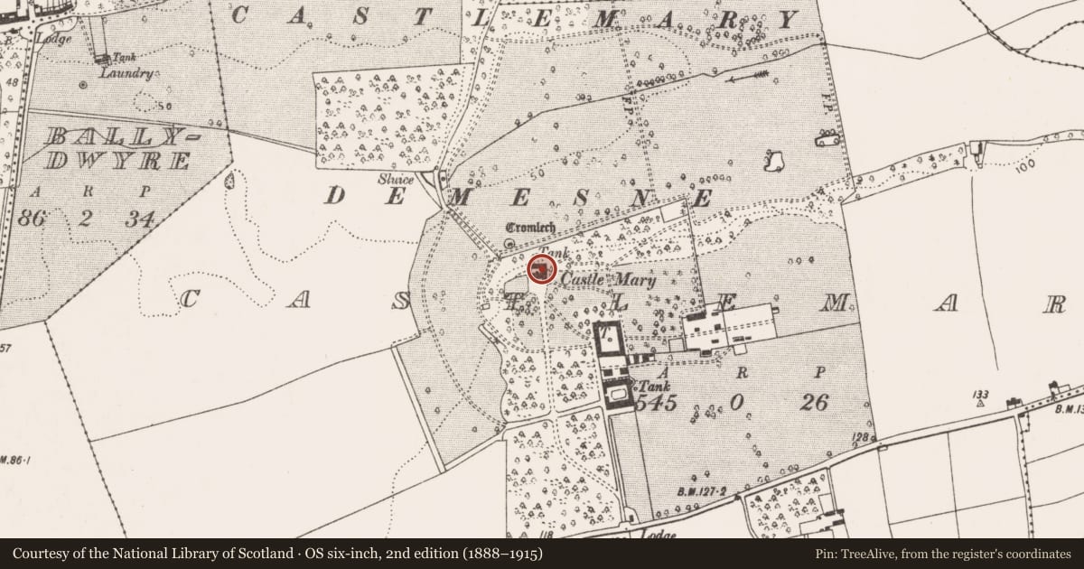
- Latest-edition OS map
- Castle Mary (1935)
- Coordinates
- 51.86010, -8.14974
- SMR number
- CO088-016001-
Slide toward Today to fade the historical sheet and see the modern map underneath.
David Rumsey Map Collection, Stanford LibrariesDavid Rumsey Map Collection, Stanford LibrariesDavid Rumsey Map Collection, Stanford LibrariesDavid Rumsey Map Collection, Stanford Libraries
4 historical maps cover this location, the earliest the 1790 map "Composite: Ireland." (David Rumsey Map Collection, Stanford Libraries).
Historical maps covering this location
- 1790 · Composite: Ireland. (David Rumsey Map Collection, Stanford Libraries)
- 1865 · Ireland, (South) Sheet. (David Rumsey Map Collection, Stanford Libraries)
- 1882 · Ireland (southern half). (David Rumsey Map Collection, Stanford Libraries)
- 1891 · Ireland 16 (David Rumsey Map Collection, Stanford Libraries)
This record in the National Monuments Service's Historic Environment Viewer ↗
The National Monuments Service's description
On top of a sheer limestone face to N, overgrown ruins of Castle Mary house incorporating part of late-medieval tower house. House is a large rambling castellated pile, built in 18th century, partially to design by Davis Duckart; subsequently rebuilt as 19th century neo-gothic castle in 'baronial' style with mullioned and transomed lights, bay windows and battlements (Glin et al. 1988, 44 & 48). Due to break in ground slope, N part only has basement which, on W side, incorporates walls of rectangular tower (int.: 6.85m N-S; 4.4m E-W); opes of tower have been modified to take wooden-framed doors and windows but on external S face (now within basement) is blocked door with pointed arch. Remains of tower house knownas Carrig Cotta (Healy 1988, 119), probably built by Fitzgeralds; house built by Longfield family and burnt in 1920 (Bence Jones 1978, 73).
The above description is derived from the published 'Archaeological Inventory of County Cork. Volume 2: East and South Cork' (Dublin: Stationery Office, 1994). In certain instances the entries have been revised and updated in the light of recent research.
Date of upload/revision: 14 January 2009
Nearby in the register
- Country houseunder 1 mi
- Megalithic structureunder 1 mi
- Kiln - limeunder 1 mi
- Fulacht fiaunder 1 mi
Other entries of the same register within about three miles of this one, by straight line.