Sites and Monuments Record · Ireland
Church
Kilbonane, County Cork, Ireland
The record
- Townland
- Kilbonane
- County
- Cork
- Country
- Ireland
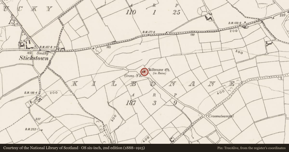
- Latest-edition OS map
- Kilbonane Church (in Ruins) (1943)
- Coordinates
- 51.84758, -8.76250
- SMR number
- CO084-012002-
Slide toward Today to fade the historical sheet and see the modern map underneath.
David Rumsey Map Collection, Stanford LibrariesDavid Rumsey Map Collection, Stanford LibrariesDavid Rumsey Map Collection, Stanford LibrariesDavid Rumsey Map Collection, Stanford Libraries
4 historical maps cover this location, the earliest the 1790 map "Composite: Ireland." (David Rumsey Map Collection, Stanford Libraries).
Historical maps covering this location
- 1790 · Composite: Ireland. (David Rumsey Map Collection, Stanford Libraries)
- 1882 · Ireland (southern half). (David Rumsey Map Collection, Stanford Libraries)
- 1883 · Ireland 3. (David Rumsey Map Collection, Stanford Libraries)
- 1891 · Ireland 16 (David Rumsey Map Collection, Stanford Libraries)
This record in the National Monuments Service's Historic Environment Viewer ↗
The National Monuments Service's description
In N half of graveyard (CO084-012001-); ruin of Kilbonane parish church. Rectangular gabled church (int.: 14.6m E-W; 6.2m N-S); walls stand to full height. Entered through door with pointed arch, near W end of S wall. Much-ruined window near E end of S wall; window high on W gable with flat-headed light; central window in E wall with double ogee-headed cusped light. Latter window now completely blocked outside by 19th-century memorial. Two rectangular presses near E end of S wall; press to W now partially buried under ground, surround has chamfered edge and probably contains piscina. Shallow rectangular slab (H 0.1m; D 0.15m; Wth 0.45m) projects from inside of E wall to N of window. S wall abuts W gable, and N wall poorly keyed to opposite end of same gable, suggesting a repair to this part of church. Interior long used for burial, earliest headstone noted dated 1740. Just inside door cone-shaped stone stoup (H 0.15m; Wth at top 0.25m; Wth at base 0.06m); at NE corner fragment of plain octagonal font (H 0.2m; max. Wth 0.6m). Present building largely late-medieval in style; it was reported in ruins in 1615 (Brady 1863, vol. 1, 313-2) but was in repair in 1639 (ibid.), these repairs probably those evident on W gable.
The above description is derived from the published 'Archaeological Inventory of County Cork. Volume 3: Mid Cork' (Dublin: Stationery Office, 1997). In certain instances the entries have been revised and updated in the light of recent research.
Date of upload/revision: 14 January 2009
Nearby in the register
- Graveyardunder 1 mi
- Fulacht fiaunder 1 mi
- Fulacht fiaunder 1 mi
- Churchunder 1 mi
Other entries of the same register within about three miles of this one, by straight line.