Sites and Monuments Record · Ireland
Megalithic tomb - wedge tomb
Derrygortnacloghy, County Cork, Ireland
The record
- Townland
- Derrygortnacloghy
- County
- Cork
- Country
- Ireland
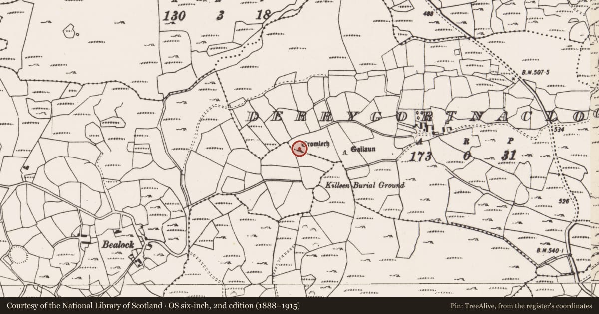
- Latest-edition OS map
- Cromlech (1904)
- Coordinates
- 51.81680, -9.11716
- SMR number
- CO081-029----
Slide toward Today to fade the historical sheet and see the modern map underneath.
David Rumsey Map Collection, Stanford LibrariesDavid Rumsey Map Collection, Stanford LibrariesDavid Rumsey Map Collection, Stanford LibrariesDavid Rumsey Map Collection, Stanford Libraries
4 historical maps cover this location, the earliest the 1790 map "Composite: Ireland." (David Rumsey Map Collection, Stanford Libraries).
Historical maps covering this location
- 1790 · Composite: Ireland. (David Rumsey Map Collection, Stanford Libraries)
- 1882 · Ireland (southern half). (David Rumsey Map Collection, Stanford Libraries)
- 1883 · Ireland 3. (David Rumsey Map Collection, Stanford Libraries)
- 1891 · Ireland 16 (David Rumsey Map Collection, Stanford Libraries)
This record in the National Monuments Service's Historic Environment Viewer ↗
The National Monuments Service's description
Towards W end of one of number of low ridges in NE foothills of Shehy Mountains; site overlooks River Lee valley to N. Comprises large, wedge-shaped gallery (L 3.5m; Wth 1.6m at W end, 1.1m at E; H 1.5m to W) aligned E-W; represented by one sidestone to N, two to S and apparent inset backstone at E end; three closely-set outer-wall stones along S side. Gallery decreases in height from W to E; covered by single roofstone. Monument formerly incorporated in townland boundary fence; fence now removed (1991). 'Cup marked capstone' (Finlay 1973, 167). (de Valera and Ó Nualláin 1982, 20-1, Co. 28)
The above description is derived from the published 'Archaeological Inventory of County Cork. Volume 3: Mid Cork' (Dublin: Stationery Office, 1997). In certain instances the entries have been revised and updated in the light of recent research.
Date of upload/revision: 14 January 2009
See linked document with details from Ruaidhrí de Valera and Seán Ó Nualláin, Survey of the Megalithic Tombs of Ireland. Volume IV. Counties Cork, Kerry, Limerick, Tipperary. (Dublin: Stationery Office, 1982)
Nearby in the register
- Standing stoneunder 1 mi
- Burial groundunder 1 mi
- Ringfort - rathunder 1 mi
- Souterrainunder 1 mi
Other entries of the same register within about three miles of this one, by straight line.