Sites and Monuments Record · Ireland
Bawn
Barryscourt, County Cork, Ireland
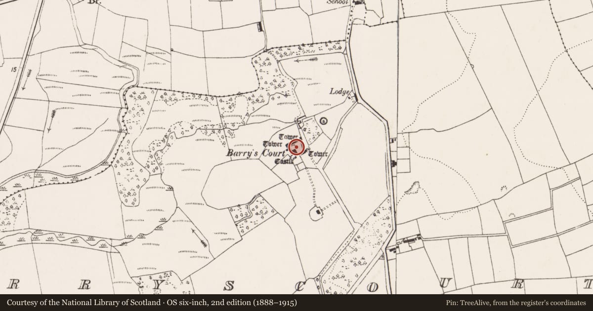
The record
- Townland
- Barryscourt
- County
- Cork
- Country
- Ireland
- Latest-edition OS map
- Barrys Court Castle, Tower(s) (1935)
- Coordinates
- 51.90465, -8.25923
- SMR number
- CO075-018003-
Slide toward Today to fade the historical sheet and see the modern map underneath.
David Rumsey Map Collection, Stanford LibrariesDavid Rumsey Map Collection, Stanford LibrariesDavid Rumsey Map Collection, Stanford LibrariesDavid Rumsey Map Collection, Stanford Libraries
4 historical maps cover this location, the earliest the 1790 map "Composite: Ireland." (David Rumsey Map Collection, Stanford Libraries).
Historical maps covering this location
- 1790 · Composite: Ireland. (David Rumsey Map Collection, Stanford Libraries)
- 1882 · Ireland (southern half). (David Rumsey Map Collection, Stanford Libraries)
- 1883 · Ireland 3. (David Rumsey Map Collection, Stanford Libraries)
- 1891 · Ireland 16 (David Rumsey Map Collection, Stanford Libraries)
This record in the National Monuments Service's Historic Environment Viewer ↗
The National Monuments Service's description
On slight rise, in flat low-lying area of reclaimed slob (Coleman 1915, 67-8). Barryscourt Castle (CO075-018001-) is located at SW corner of, and partially enclosed by, a bawn wall which has towers at SE, NE and NW corners. Internal face of E, N and W bawn walls partially obscured by and lowered to accommodate 18th\19th century farm buildings. S bawn wall (L 24.5m) heavily reconstructed; 2-storey 19th-century farmhouse, now coffee-shop, built against external face. Original entry to bawn through rebuilt segmental-arched gateway in S bawn wall. SE corner tower (5.4m x 5m) recently repaired. E bawn wall (L 44m) has recent break near SE tower. NE tower (c. 5.2m x 5m) has vaulted chamber lit by slit windows partially blocked to form musket loops.
N bawn wall runs W for 34.5m, then returns N for short distance (L c. 4m) before running W a further 10.5m, latter section wider and more prominently battered. NW tower (c. 4.5m N-S; c. 4.0m E-W), flush with N bawn wall, projects to W; contains chamber with large garderobe. W bawn wall (L 32.5m) has two large double-light pointed-arch windows with widely-splayed embrasures and window seats. At S end of W wall short return E (L c. 7m) to NW corner of tower house.
Underlying W bawn wall and NW tower, on slightly different alignments, wall foundations of undressed masonry, indicate presence of earlier structure; similar wall recently uncovered near NE corner of bawn (Lenon 1989a). Projecting section of N bawn wall, NW tower and W bawn wall, all part of early hall-type structure possibly in 13th/14th century, largely 15th century. Otherwise bawn wall and its corner towers of 15th century date; NW and SE towers refurbished in 16th century.
The above description is derived from the published 'Archaeological Inventory of County Cork. Volume 2: East and South Cork' (Dublin: Stationery Office, 1994). In certain instances the entries have been revised and updated in the light of recent research.
Date of upload/revision: 14 January 2009
This monument is subject to a preservation order made under the National Monuments Acts 1930 to 2014 (PO no. 4/1974).
Nearby in the register
- Castle - tower houseunder 1 mi
- Fulacht fiaunder 1 mi
- Fulacht fiaunder 1 mi
- Fulacht fiaunder 1 mi
Other entries of the same register within about three miles of this one, by straight line.