Sites and Monuments Record · Ireland
Mill - cloth
Poulacurry South, County Cork, Ireland
The record
- Townland
- Poulacurry South
- County
- Cork
- Country
- Ireland
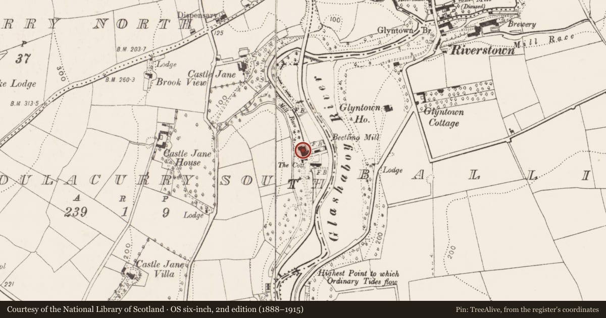
- Latest-edition OS map
- Beetling Mill (1902)
- Coordinates
- 51.92362, -8.39525
- SMR number
- CO075-001----
Slide toward Today to fade the historical sheet and see the modern map underneath.
David Rumsey Map Collection, Stanford LibrariesDavid Rumsey Map Collection, Stanford LibrariesDavid Rumsey Map Collection, Stanford LibrariesDavid Rumsey Map Collection, Stanford Libraries
4 historical maps cover this location, the earliest the 1790 map "Composite: Ireland." (David Rumsey Map Collection, Stanford Libraries).
Historical maps covering this location
- 1790 · Composite: Ireland. (David Rumsey Map Collection, Stanford Libraries)
- 1882 · Ireland (southern half). (David Rumsey Map Collection, Stanford Libraries)
- 1883 · Ireland 3. (David Rumsey Map Collection, Stanford Libraries)
- 1891 · Ireland 16 (David Rumsey Map Collection, Stanford Libraries)
This record in the National Monuments Service's Historic Environment Viewer ↗
The National Monuments Service's description
On W bank of Glashaboy river 0.5km N of Glanmire. L-shaped complex shown on 1842 OS 6-inch map as Cloth mill; shown as Beetling mill on 1902 OS 6-inch map. Present L-shaped layout is constructed in two phases. Earliest structure (long axis N-S) on W side is of 4 storeys gable-ended with attic; stone-arched window opes. Attached to S end E wall is 4-storey, 7-bay mill (long axis E-W), with wheel-pit along E wall. Windows with brick surrounds with roof gabled to W, half hipped to E; date plaque (1796) on weatherslated S elevation. Smaller mid/late 19th century mill (long axis E-W) to N; decorated bargeboards along gable ends; wheel pit along E gable. Mill pond to N; two millraces flow S to power both mills. According to local information turbine installed 1929. Access to interior not gained. Functioned as saw-mill in recent past, now functions as furniture factory.
The above description is derived from the published 'Archaeological Inventory of County Cork. Volume 2: East and South Cork' (Dublin: Stationery Office, 1994). In certain instances the entries have been revised and updated in the light of recent research.
Date of upload/revision: 14 January 2009
Nearby in the register
- Moundunder 1 mi
- Coach houseunder 1 mi
- Bridgeunder 1 mi
- Bridgeunder 1 mi
Other entries of the same register within about three miles of this one, by straight line.