Sites and Monuments Record · Ireland
Graveyard
Brooklodge (Barrymore By.), County Cork, Ireland
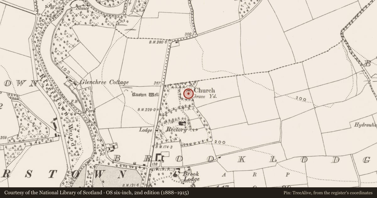
The record
- Townland
- Brooklodge (Barrymore By.)
- County
- Cork
- Country
- Ireland
- First-edition OS map
- NULL
- Latest-edition OS map
- Grave Yard (1935)
- Coordinates
- 51.93850, -8.37711
- SMR number
- CO064-054001-
Slide toward Today to fade the historical sheet and see the modern map underneath.
David Rumsey Map Collection, Stanford LibrariesDavid Rumsey Map Collection, Stanford LibrariesDavid Rumsey Map Collection, Stanford LibrariesDavid Rumsey Map Collection, Stanford Libraries
4 historical maps cover this location, the earliest the 1790 map "Composite: Ireland." (David Rumsey Map Collection, Stanford Libraries).
Historical maps covering this location
- 1790 · Composite: Ireland. (David Rumsey Map Collection, Stanford Libraries)
- 1882 · Ireland (southern half). (David Rumsey Map Collection, Stanford Libraries)
- 1883 · Ireland 3. (David Rumsey Map Collection, Stanford Libraries)
- 1891 · Ireland 16 (David Rumsey Map Collection, Stanford Libraries)
This record in the National Monuments Service's Historic Environment Viewer ↗
The National Monuments Service's description
Approached by laneway from W; subrectangular graveyard (c. 60m N-S; c. 60m E-W) enclosing site of ancient parish church (CO064-054002-), in ruins by 1615 (Brady 1863, vol. 1, 26). In 1700 the church described as 'built with stone and clay; half the walls are down; the churchyard is fenct with a ditch'. C of I church of Riverstown built here in 1829 (Lewis 1837, vol. 1); according to local information demolished in 1923; stones used to rebuilt nearby Butlerstown House. Short section of W wall of church survives with tower attached; hexagonal with spire, on rectangular base (2.9m N-S; 3.8m E-). Inscribed headstones date from mid-19th century; in occasional use. Parish 'sometimes called Kilroan' (Lewis 1837, vol. 1, 132), 'better known as Ballylucra' (Coleman 1907-9e, 258); Ruown well (CO064-053----) to W.
The above description is derived from the published 'Archaeological Inventory of County Cork. Volume 2: East and South Cork' (Dublin: Stationery Office, 1994). In certain instances the entries have been revised and updated in the light of recent research.
Date of upload/revision: 14 January 2009
Nearby in the register
- Churchunder 1 mi
- Ritual site - holy wellunder 1 mi
- Mill - fullingunder 1 mi
- Kiln - limeunder 1 mi
Other entries of the same register within about three miles of this one, by straight line.