Sites and Monuments Record · Ireland
Graveyard
Coolnacaha, County Cork, Ireland
The record
- Townland
- Coolnacaha
- County
- Cork
- Country
- Ireland
- First-edition OS map
- NULL
- Latest-edition OS map
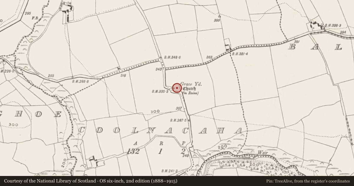
- Grave Yard (1935)
- Coordinates
- 51.96141, -8.37276
- SMR number
- CO064-012001-
Slide toward Today to fade the historical sheet and see the modern map underneath.
David Rumsey Map Collection, Stanford LibrariesDavid Rumsey Map Collection, Stanford LibrariesDavid Rumsey Map Collection, Stanford LibrariesDavid Rumsey Map Collection, Stanford Libraries
4 historical maps cover this location, the earliest the 1790 map "Composite: Ireland." (David Rumsey Map Collection, Stanford Libraries).
Historical maps covering this location
- 1790 · Composite: Ireland. (David Rumsey Map Collection, Stanford Libraries)
- 1882 · Ireland (southern half). (David Rumsey Map Collection, Stanford Libraries)
- 1883 · Ireland 3. (David Rumsey Map Collection, Stanford Libraries)
- 1891 · Ireland 16 (David Rumsey Map Collection, Stanford Libraries)
This record in the National Monuments Service's Historic Environment Viewer ↗
The National Monuments Service's description
On E side of road; trapezoidal graveyard (c. 40m N-S; c. 40m E-W) enclosed by stone wall. In occasional use; earliest headstones date from 18th century; seven chest tombs, some finely carved. To W of centre remains of tower (3.2m N-S; surviving for 2.9m E-W; H c. 7m), entirely missing its E wall; blocked door opes in S and W walls. Floors and roof gone but slender stone pyramid atop SW corner of surviving structure. Tower appears to be no older than 18th century; according to Power (1923, 176) 'probably added, in comparatively recent times, to an older church'. No visible surface trace of ancient parish church (CO064-012002-) of Killaspugmullane, in repair in 1615 but described in 1700 as 'about 46 foot long and 17 foot broad; half the walls are down' (Brady 1863, vol. 1, 153-5); church here out of use by 1829 (ibid., 157).
The above description is derived from the published 'Archaeological Inventory of County Cork. Volume 2: East and South Cork' (Dublin: Stationery Office, 1994). In certain instances the entries have been revised and updated in the light of recent research.
Date of upload/revision: 14 January 2009
Nearby in the register
- Churchunder 1 mi
- Burnt moundunder 1 mi
- Ringfort - rathunder 1 mi
- Ringfort - rathunder 1 mi
Other entries of the same register within about three miles of this one, by straight line.