Sites and Monuments Record · Ireland
Castle - tower house
Carrignavar, County Cork, Ireland
The record
- Townland
- Carrignavar
- County
- Cork
- Country
- Ireland
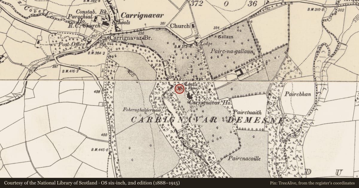
- Latest-edition OS map
- Castle (in Ruins) (1935)
- Coordinates
- 51.98521, -8.47264
- SMR number
- CO063-022001-
Slide toward Today to fade the historical sheet and see the modern map underneath.
David Rumsey Map Collection, Stanford LibrariesDavid Rumsey Map Collection, Stanford LibrariesDavid Rumsey Map Collection, Stanford LibrariesDavid Rumsey Map Collection, Stanford Libraries
4 historical maps cover this location, the earliest the 1790 map "Composite: Ireland." (David Rumsey Map Collection, Stanford Libraries).
Historical maps covering this location
- 1790 · Composite: Ireland. (David Rumsey Map Collection, Stanford Libraries)
- 1882 · Ireland (southern half). (David Rumsey Map Collection, Stanford Libraries)
- 1883 · Ireland 3. (David Rumsey Map Collection, Stanford Libraries)
- 1891 · Ireland 16 (David Rumsey Map Collection, Stanford Libraries)
This record in the National Monuments Service's Historic Environment Viewer ↗
The National Monuments Service's description
On crest of steep W-facing slope, overlooking Cloghnagashee river. Rectangular tower largely reduced to mound of rubble (H c. 4m; 13m E-W; 8m N-S), except lower part of W wall with short returns at either end, and part of corner turret projecting from N end of W wall (5.7m E-W; int. 2.9m N-S). Retaining wall to S appears recent as does short wall on S side of turret; these may be part of 'recent repairs' noted by O'Donoghue (1914). Just S of centre in W wall, upper part of stone arch of door survives: pointed in two orders with chamfered edges. According to Coleman (1907, 169), 'Daniel MacCarthy built the castle of Carrignavar in 1616'; a photograph of c. 1907 (ibid., facing p. 172) shows the castle heavily ivy-clad but standing to at least two storeys.
The above description is derived from the published 'Archaeological Inventory of County Cork. Volume 2: East and South Cork' (Dublin: Stationery Office, 1994). In certain instances the entries have been revised and updated in the light of recent research.
Date of upload/revision: 14 January 2009
Nearby in the register
- Standing stoneunder 1 mi
- Churchunder 1 mi
- Standing stoneunder 1 mi
- Bridgeunder 1 mi
Other entries of the same register within about three miles of this one, by straight line.