Sites and Monuments Record · Ireland
Graveyard
Coolineagh, County Cork, Ireland
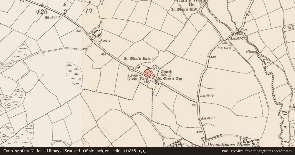
The record
- Townland
- Coolineagh
- County
- Cork
- Country
- Ireland
- First-edition OS map
- NULL
- Latest-edition OS map
- Grave Yd (1937)
- Coordinates
- 51.95248, -8.81603
- SMR number
- CO061-080002-
Slide toward Today to fade the historical sheet and see the modern map underneath.
David Rumsey Map Collection, Stanford LibrariesDavid Rumsey Map Collection, Stanford LibrariesDavid Rumsey Map Collection, Stanford LibrariesDavid Rumsey Map Collection, Stanford Libraries
4 historical maps cover this location, the earliest the 1790 map "Composite: Ireland." (David Rumsey Map Collection, Stanford Libraries).
Historical maps covering this location
- 1790 · Composite: Ireland. (David Rumsey Map Collection, Stanford Libraries)
- 1882 · Ireland (southern half). (David Rumsey Map Collection, Stanford Libraries)
- 1883 · Ireland 3. (David Rumsey Map Collection, Stanford Libraries)
- 1891 · Ireland 16 (David Rumsey Map Collection, Stanford Libraries)
This record in the National Monuments Service's Historic Environment Viewer ↗
The National Monuments Service's description
On N side of road, within early ecclesiastical enclosure (9199); subrectangular graveyard (c. 70m E-W; c. 45m N-S) enclosed by stone wall. In occasional use; many 18th- and 19th-century inscribed headstones, the earliest noted dated 1794, also some low uninscribed gravemarkers. Immediately E of church ruins is inscribed, late-medieval graveslab, broken into three pieces (0.67m x 1.7m): ringed eight-armed fleur-de-lis cross-head with shaft rising from stepped base. In SE quadrant stands an ogham stone (7960); in NE corner is a relocated saint's stone (9247); at centre fragmentary remains of successive 18th- and 19th- century C of I parish churches of Aghabulloge (9578); in the demolition of earlier of these an ogham stone was found (7960).
The above description is derived from the published 'Archaeological Inventory of County Cork. Volume 3: Mid Cork' (Dublin: Stationery Office, 1997). In certain instances the entries have been revised and updated in the light of recent research.
Date of upload/revision: 14 January 2009
Nearby in the register
- Ecclesiastical siteunder 1 mi
- Churchunder 1 mi
- Ogham stoneunder 1 mi
- Churchunder 1 mi
Other entries of the same register within about three miles of this one, by straight line.