Sites and Monuments Record · Ireland
Cairn - radial-stone cairn
Rusheen (Muskerry East By.), County Cork, Ireland
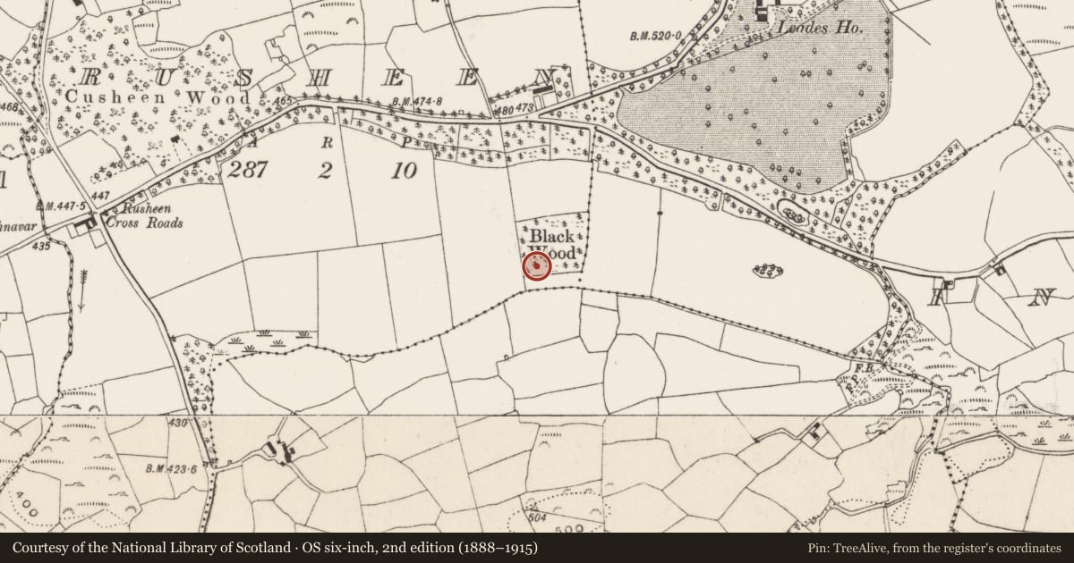
The record
- Townland
- Rusheen (Muskerry East By.)
- County
- Cork
- Country
- Ireland
- First-edition OS map
- NULL
- Latest-edition OS map
- Not indicated
- Coordinates
- 51.93079, -8.89209
- SMR number
- CO060-202001-
Slide toward Today to fade the historical sheet and see the modern map underneath.
David Rumsey Map Collection, Stanford LibrariesDavid Rumsey Map Collection, Stanford LibrariesDavid Rumsey Map Collection, Stanford LibrariesDavid Rumsey Map Collection, Stanford Libraries
4 historical maps cover this location, the earliest the 1790 map "Composite: Ireland." (David Rumsey Map Collection, Stanford Libraries).
Historical maps covering this location
- 1790 · Composite: Ireland. (David Rumsey Map Collection, Stanford Libraries)
- 1882 · Ireland (southern half). (David Rumsey Map Collection, Stanford Libraries)
- 1883 · Ireland 3. (David Rumsey Map Collection, Stanford Libraries)
- 1891 · Ireland 16 (David Rumsey Map Collection, Stanford Libraries)
This record in the National Monuments Service's Historic Environment Viewer ↗
The National Monuments Service's description
In a woodland copse, on a flat terrace of a gentle S-facing slope. The N of two linked cairns consists of a ring of nine radially-set stones (diam. 6m) protruding from the remains of a disturbed cairn (max. H 0.5m). Stones vary in height from 0.2m to 0.57m above the cairn surface. The cairn extends to SW as a narrow (Wth 0.5m) causeway-like feature (L 3m) where it joins with its counterpart (CO060-202002-). Two uprights (max. H 0.57m) protrude from the NW edge of this causeway. The ground plan of both monuments resembles a pair of spectacles.
The above description is derived from 'The Archaeological Inventory of County Cork. Volume 5' (Dublin: Stationery Office, 2009).
Date of upload: 22 December 2009
Nearby in the register
- Cairn - radial-stone cairnunder 1 mi
- Standing stoneunder 1 mi
- Kiln - limeunder 1 mi
- Kiln - limeunder 1 mi
Other entries of the same register within about three miles of this one, by straight line.