Sites and Monuments Record · Ireland
Fulacht fia
Scartbarry, County Cork, Ireland
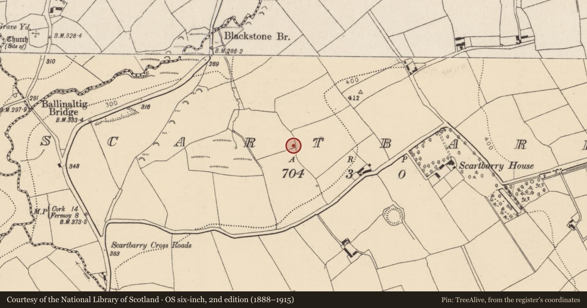
The record
- Townland
- Scartbarry
- County
- Cork
- Country
- Ireland
- First-edition OS map
- NULL
- Latest-edition OS map
- Not indicated
- Coordinates
- 52.04007, -8.31562
- SMR number
- CO053-103----
Slide toward Today to fade the historical sheet and see the modern map underneath.
David Rumsey Map Collection, Stanford LibrariesDavid Rumsey Map Collection, Stanford LibrariesDavid Rumsey Map Collection, Stanford LibrariesDavid Rumsey Map Collection, Stanford Libraries
4 historical maps cover this location, the earliest the 1790 map "Composite: Ireland." (David Rumsey Map Collection, Stanford Libraries).
Historical maps covering this location
- 1790 · Composite: Ireland. (David Rumsey Map Collection, Stanford Libraries)
- 1865 · Ireland, (South) Sheet. (David Rumsey Map Collection, Stanford Libraries)
- 1882 · Ireland (southern half). (David Rumsey Map Collection, Stanford Libraries)
- 1891 · Ireland 16 (David Rumsey Map Collection, Stanford Libraries)
This record in the National Monuments Service's Historic Environment Viewer ↗
The National Monuments Service's description
A spread (diam. c. 10m) of heat-shattered stones and charcoal-enriched soil was uncovered during testing in advance of the construction of the N8 Rathcormac-Fermoy Bypass. Subsequent excavation in 2003 revealed that the spread overlay associated pits, a trough containing a number of stake-holes as well as a stone-flanked channel (D 0.7m) on an E-W orientation which was enclosed by a stone-lined slot trench (diam. 4m) with associated post-holes and entrance feature. Connected to the E via a step upwards was a second oval-shaped structure with large stone slabs laid along the base; stone walls further enclosed the cut on the E, N and S sides. The radiocarbon dates obtained from this fulacht fia indicate that it was in use from the Early/Middle Bronze Age (NRA website). (Murphy 2004, 89, Scartbarry 1; O'Neill 2006a, 75, Scartbarry 1)
The above description is derived from 'The Archaeological Inventory of County Cork. Volume 5' (Dublin: Stationery Office, 2009).
Date of upload: 22 December 2009
Nearby in the register
- Fulacht fiaunder 1 mi
- Ringfort - rathunder 1 mi
- Kiln - corn-dryingunder 1 mi
- Excavation - miscellaneousunder 1 mi
Other entries of the same register within about three miles of this one, by straight line.