Sites and Monuments Record · Ireland
Hospital
Mallow (Fermoy By.), County Cork, Ireland
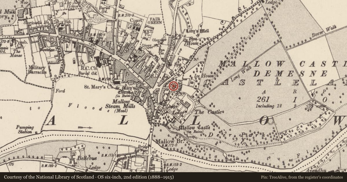
The record
- Townland
- Mallow (Fermoy By.)
- County
- Cork
- Country
- Ireland
- Latest-edition OS map
- County Infirmary (1935)
- Coordinates
- 52.13542, -8.63953
- SMR number
- CO033-009005-
Slide toward Today to fade the historical sheet and see the modern map underneath.
David Rumsey Map Collection, Stanford LibrariesDavid Rumsey Map Collection, Stanford LibrariesDavid Rumsey Map Collection, Stanford LibrariesDavid Rumsey Map Collection, Stanford Libraries
4 historical maps cover this location, the earliest the 1790 map "Composite: Ireland." (David Rumsey Map Collection, Stanford Libraries).
Historical maps covering this location
- 1790 · Composite: Ireland. (David Rumsey Map Collection, Stanford Libraries)
- 1882 · Ireland (southern half). (David Rumsey Map Collection, Stanford Libraries)
- 1883 · Ireland 3. (David Rumsey Map Collection, Stanford Libraries)
- 1904 · Sheet 13. (David Rumsey Map Collection, Stanford Libraries)
This record in the National Monuments Service's Historic Environment Viewer ↗
The National Monuments Service's description
Abandoned rectangular 3-storey structure in Mallow, adjoining W end of farm buildings of Mallow Castle Demesne (14872). Indicated as L-shaped structure named 'County Infirmary' on 1842 OS 6-inch map. Entrance front (S) of 5 bays; random-rubble limestone construction; central flat brick-arched door ope; flat brick-arched window opes (frames removed), 2nd floor window has moulded 18th century sill; brick cornice under eaves. Shallow hipped slate roof, in very poor repair. West elevation of 2 bays with blind windows. West elevation prolonged to N by addition of 2-bays of similar construction, making overall plan L-shaped. Lewis (1837, vol. 2, 341) described it as 'a neat plain building ... at present, accommodating 14 patients, but is capable of containing 30'. Structure demolished by 1997, apart from E gable which adjoins farm buildings.
The above description is derived from the published 'Archaeological Inventory of County Cork. Volume 4: North Cork' (Dublin: Stationery Office, 2000). In certain instances the entries have been revised and updated in the light of recent research.
Date of upload/revision: 14 January 2009
Nearby in the register
- Icehouseunder 1 mi
- Country houseunder 1 mi
- Market-houseunder 1 mi
- House - fortified houseunder 1 mi
Other entries of the same register within about three miles of this one, by straight line.