Sites and Monuments Record · Ireland
Church
Newberry, County Cork, Ireland
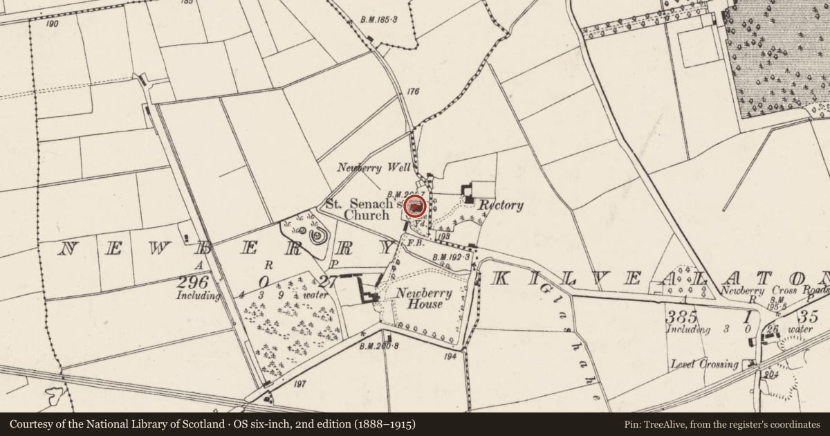
The record
- Townland
- Newberry
- County
- Cork
- Country
- Ireland
- Latest-edition OS map
- St Senachs Church (1936)
- Coordinates
- 52.12272, -8.70743
- SMR number
- CO032-107003-
Slide toward Today to fade the historical sheet and see the modern map underneath.
David Rumsey Map Collection, Stanford LibrariesDavid Rumsey Map Collection, Stanford LibrariesDavid Rumsey Map Collection, Stanford LibrariesDavid Rumsey Map Collection, Stanford Libraries
4 historical maps cover this location, the earliest the 1790 map "Composite: Ireland." (David Rumsey Map Collection, Stanford Libraries).
Historical maps covering this location
- 1790 · Composite: Ireland. (David Rumsey Map Collection, Stanford Libraries)
- 1882 · Ireland (southern half). (David Rumsey Map Collection, Stanford Libraries)
- 1883 · Ireland 3. (David Rumsey Map Collection, Stanford Libraries)
- 1904 · Sheet 13. (David Rumsey Map Collection, Stanford Libraries)
This record in the National Monuments Service's Historic Environment Viewer ↗
The National Monuments Service's description
In N half of graveyard (14611). Former C of I parish church of Kilshannig; converted to craft centre in 1984. Built of random-rubble limestone construction with cut stone detail. Consists of 4-storey tower (int.: 3.12m N-S; 3.57m E-W) at W end of rectangular nave (int.: 14m E-W; 4.5m N-S) with chancel (6.2m E-W) added to E, of similar in width to nave; porch entrance added to W end of S wall of nave, and a gable-ended aisle is added to N of nave and tower. Nave has two paired lancets in S wall which replaced three earlier windows now blocked; slender buttresses on corners. Tower appears to incorporate part of earlier structure: base of walls noticeably battered and S wall is over 1m thick. Tower has blocked-up pointed door ope in W wall. In wall above blocked door is inscribed stone plaque with date of '1719'; directly overhead is slim window ope, at top of which is inserted head of double cusped ogee-headed light (central mullion removed). Chancel has three lancet windows in centre of E wall. Interior renovated in 1984; pulpit and some wall memorials survive. Nave divided from isle by three-bay pointed arcade springing from stone piers. During conversion head of round-arched window light (0.43m x 0.33m) was found: edge chamfered; sunken spandrels carved with primitive human heads (c. 0.12m x 0.10m) According to Grove White (1905-25, vol. 3, 343), built in 1719 to accommodate 340 persons. In 1882 numerous improvements made including heating system, wicket gate and piers (Cole 1903, 221-2). Lewis (1837, vol. 2, 208) refers to spire atop tower which was removed in 1815. Multi-period church on or near site (and possibly incorporating part) of earlier parish church of Kilshannig which was noted in charter of 1242 (MacCotter and Nicholls 1996, 65); reported 'in ruins' in 1612 (Brady 1863, vol. 2, 287-289).
The above description is derived from the published 'Archaeological Inventory of County Cork. Volume 4: North Cork' (Dublin: Stationery Office, 2000). In certain instances the entries have been revised and updated in the light of recent research.
Date of upload/revision: 14 January 2009
Nearby in the register
- Graveyardunder 1 mi
- Graveslabunder 1 mi
- Architectural fragmentunder 1 mi
- Bridgeunder 1 mi
Other entries of the same register within about three miles of this one, by straight line.