Sites and Monuments Record · Ireland
Castle - unclassified
Johnstown East,Johnstown West, County Cork, Ireland
The record
- Townland
- Johnstown East,Johnstown West
- County
- Cork
- Country
- Ireland
- Latest-edition OS map
- Not indicated
- Coordinates
- 52.17142, -8.35896
- SMR number
- CO027-191----
Slide toward Today to fade the historical sheet and see the modern map underneath.
David Rumsey Map Collection, Stanford LibrariesDavid Rumsey Map Collection, Stanford LibrariesDavid Rumsey Map Collection, Stanford LibrariesDavid Rumsey Map Collection, Stanford Libraries
4 historical maps cover this location, the earliest the 1790 map "Composite: Ireland." (David Rumsey Map Collection, Stanford Libraries).
Historical maps covering this location
- 1790 · Composite: Ireland. (David Rumsey Map Collection, Stanford Libraries)
- 1882 · Ireland (southern half). (David Rumsey Map Collection, Stanford Libraries)
- 1891 · Ireland 16 (David Rumsey Map Collection, Stanford Libraries)
- 1904 · Sheet 13. (David Rumsey Map Collection, Stanford Libraries)
This record in the National Monuments Service's Historic Environment Viewer ↗
The National Monuments Service's description
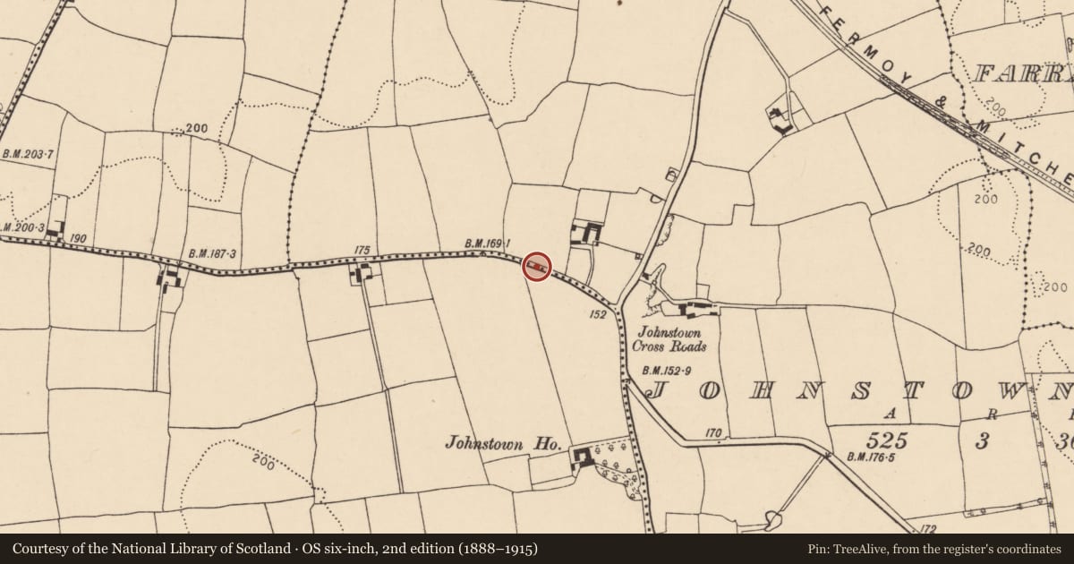
Stretch of wall (L 21m; H 2.8m) on N side of road c. 120m NW of Johnstown Cross Roads appears medieval in character: built of limestone rubble construction with numerous put-log holes. Possibly part of a bawn wall, but known locally as 'Cloister Wall'. Fragment of cut stone built into recent wall at rear of nearby bungalow appears to be part of late medieval ogee-headed window.
Down Survey (1655-6) barony map shows castle in 'Johnstowne' townland in this general area. Possessions of Cistercian Abbey of Fermoy at time of Dissolution included 'a castle' and 300 acres of land at 'Johnstowne' (White 1943, 145); leased c. 1552 to Humfrey Warren (Grove White 1905-25, vol. 3, 95), subsequently granted, in 1577, to Theobald Roche of Cregg (ibid., vol. 2, 270).
The above description is derived from the published 'Archaeological Inventory of County Cork. Volume 4: North Cork' (Dublin: Stationery Office, 2000). In certain instances the entries have been revised and updated in the light of recent research.
Date of upload/revision: 14 January 2009
Nearby in the register
- Kiln - limeunder 1 mi
- Ringfort - rathunder 1 mi
- Megalithic structureunder 1 mi
- House - vernacular houseunder 1 mi
Other entries of the same register within about three miles of this one, by straight line.