Sites and Monuments Record · Ireland
Country house
Ballyclogh (Fermoy By.), County Cork, Ireland
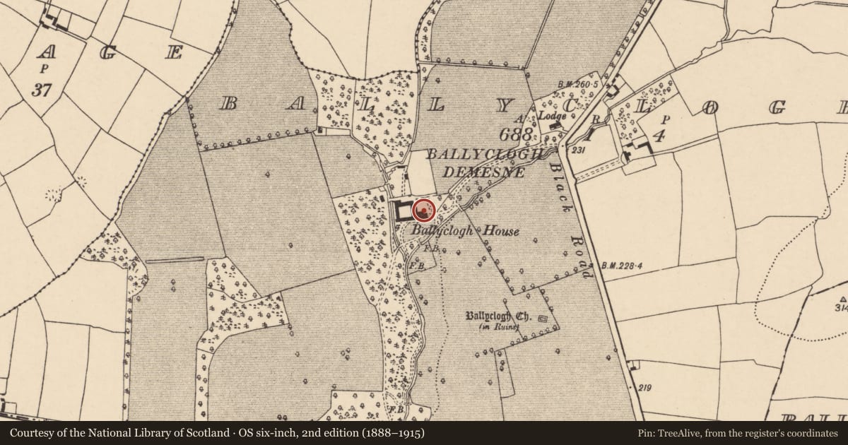
The record
- Townland
- Ballyclogh (Fermoy By.)
- County
- Cork
- Country
- Ireland
- First-edition OS map
- NULL
- Latest-edition OS map
- Ballyclogh House (1934)
- Coordinates
- 52.18979, -8.30951
- SMR number
- CO027-190----
Slide toward Today to fade the historical sheet and see the modern map underneath.
David Rumsey Map Collection, Stanford LibrariesDavid Rumsey Map Collection, Stanford LibrariesDavid Rumsey Map Collection, Stanford LibrariesDavid Rumsey Map Collection, Stanford Libraries
4 historical maps cover this location, the earliest the 1790 map "Composite: Ireland." (David Rumsey Map Collection, Stanford Libraries).
Historical maps covering this location
- 1790 · Composite: Ireland. (David Rumsey Map Collection, Stanford Libraries)
- 1882 · Ireland (southern half). (David Rumsey Map Collection, Stanford Libraries)
- 1891 · Ireland 16 (David Rumsey Map Collection, Stanford Libraries)
- 1904 · Sheet 13. (David Rumsey Map Collection, Stanford Libraries)
This record in the National Monuments Service's Historic Environment Viewer ↗
The National Monuments Service's description
Greater part of house demolition by Land Commission (B. Power, Avondhu 6/2/97); all that now stands are parts of square range of farm buildings formerly on W side of house. Projection at S end of E range was rebuilt in 1904 and now used as residence, N range in use as stables. Fragmentary remains survive of E, W and S ranges: E range has remains of fireplace and brick-domed bread oven. House was '2 storey with a mildly Gothic 19th-century front of 7 bays. Stepped gables, battlements, a pair of buttresses at either end; mullioned windows. Hall with impressive Tudor-Revival staircase' (Bence-Jones 1978, 20). According to Pike (1911, 73), house 'said to be 300 years old and has been added to from time to time'. 'Castle and lands of Ballyclohee' included in grant of lands to Arthur Hyde in 1588 (Grove White 1905-25, vol. 2, 89).
The above description is derived from the published 'Archaeological Inventory of County Cork. Volume 4: North Cork' (Dublin: Stationery Office, 2000). In certain instances the entries have been revised and updated in the light of recent research.
Date of upload/revision: 14 January 2009
Nearby in the register
- Graveyardunder 1 mi
- Churchunder 1 mi
- Enclosureunder 1 mi
- Ringfort - rathunder 1 mi
Other entries of the same register within about three miles of this one, by straight line.