Sites and Monuments Record · Ireland
Church
Glanworth, County Cork, Ireland
The record
- Townland
- Glanworth
- County
- Cork
- Country
- Ireland
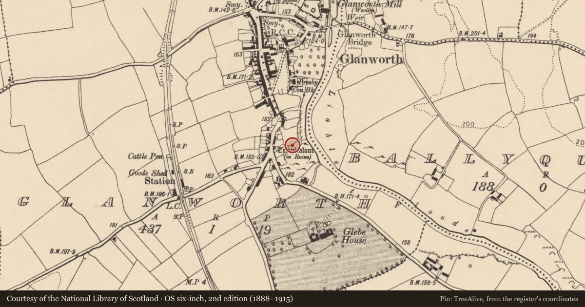
- Latest-edition OS map
- Templealour (in Ruins) (1934)
- Coordinates
- 52.18439, -8.35545
- SMR number
- CO027-078002-
Slide toward Today to fade the historical sheet and see the modern map underneath.
David Rumsey Map Collection, Stanford LibrariesDavid Rumsey Map Collection, Stanford LibrariesDavid Rumsey Map Collection, Stanford LibrariesDavid Rumsey Map Collection, Stanford Libraries
4 historical maps cover this location, the earliest the 1790 map "Composite: Ireland." (David Rumsey Map Collection, Stanford Libraries).
Historical maps covering this location
- 1790 · Composite: Ireland. (David Rumsey Map Collection, Stanford Libraries)
- 1882 · Ireland (southern half). (David Rumsey Map Collection, Stanford Libraries)
- 1891 · Ireland 16 (David Rumsey Map Collection, Stanford Libraries)
- 1904 · Sheet 13. (David Rumsey Map Collection, Stanford Libraries)
This record in the National Monuments Service's Historic Environment Viewer ↗
The National Monuments Service's description
At S end of Glanworth village, on edge of break in slope above steep drop to River Funshion to E. Ivy-clad stump of masonry (max. c. 1.5m E-W; c. 2.3m N-S; max. H c. 3m), immediately E of concrete shed and on S side of field boundary, only visible remains of church. 1842 OS 6-inch map appears to show this church c. 20 to SW (on site now occupied by grain warehouse); depicted as small rectangular structure (c. 7m WSW-ENE; c. 4m NNW-SSE) and labelled 'Grave Yd. (Site of)' and 'Templealour (in Ruins)'. Photograph of 1912, (Grove White 1905-25, vol. 3, opp. 132) shows stump as it is to-day, though Power (1932, 61) described church as of 'one compartment only, but...strongly built ... walls (Wth 3ft) battered externally, standing to height 4-5ft except on corner (H 8ft)'; this may be description of structure shown on 1842 OS 6-inch map. Power (ibid.) translates name, Teampull an Lobhair, as 'Church of the Lepers'.
The above description is derived from the published 'Archaeological Inventory of County Cork. Volume 4: North Cork' (Dublin: Stationery Office, 2000). In certain instances the entries have been revised and updated in the light of recent research.
Date of upload/revision: 14 January 2009
Nearby in the register
- Graveyardunder 1 mi
- Country houseunder 1 mi
- Churchunder 1 mi
- Historic townunder 1 mi
Other entries of the same register within about three miles of this one, by straight line.